
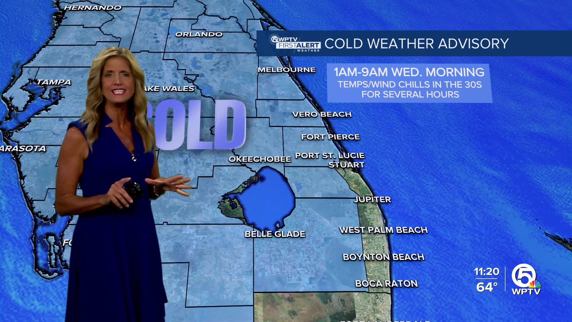


A cold weather advisory is in effect for Martin, St. Lucie, Indian River, Okeechobee and inland Palm Beach counties starting at 1 a.m. Wednesday. Wind chills could be hazardous for those without adequate warmth, clothing or shelter.
For information about cold weather shelters opening in our viewing area, click here.
MORE WEATHER: Radar | Alerts | 7-Day Forecast | Hourly Forecast
South Florida is ending the year and ringing in the New Year with a noticeable cold spell.
A cold front is moving through the region, bringing some early low clouds before sunshine takes over this afternoon.
Even with clear skies, temperatures will stay cooler than normal, with highs reaching the mid-60s around Lake Okeechobee and the Treasure Coast, and low to mid-70s across Palm Beach County areas.
The coldest air arrives tonight into New Year's Eve morning.
Overnight temperatures will drop into the low to mid-40s for Palm Beach County, and mid-upper 30s for the Treasure Coast.
A Cold Weather Advisory is in effect from 1 a.m. to 9 a.m. Wednesday for Inland Palm Beach County, and the rest of the Treasure Coast and Okeechobee counties, where wind chills could fall below 35 degrees.
Metro areas along the coast will also feel the chill, with wind chills in the upper 30s.
New Year's Eve will remain cool and breezy, with highs only in the low 60s near the lake and mid to upper 60s elsewhere. Temperatures will fall quickly after sunset, with inland areas dipping into the 40s by midnight as 2026 begins.
Another chilly morning is possible on New Year's Day, with lows in the 30s for the Treasure Coast and the low/mid 40s for Palm Beach County, but a gradual warm-up is expected heading into the weekend.
Beach and marine hazards continue alongside the cold. A high risk of rip currents remains in effect for the Palm Beaches through Wednesday, and hazardous boating conditions are expected Tuesday across both Atlantic and Gulf waters. Temperatures will stay below normal through the end of the week before moderating closer to seasonal levels this weekend.
**Portions of this story were assisted by artificial intelligence tools and reviewed by a WPTV journalists to ensure accuracy, clarity, and adherence to editorial standards.


