


WEST PALM BEACH, Fla. — South Florida will see a warm and mainly dry Christmas week as a strong area of high pressure stretches from the eastern U.S. down toward the Florida Straits.
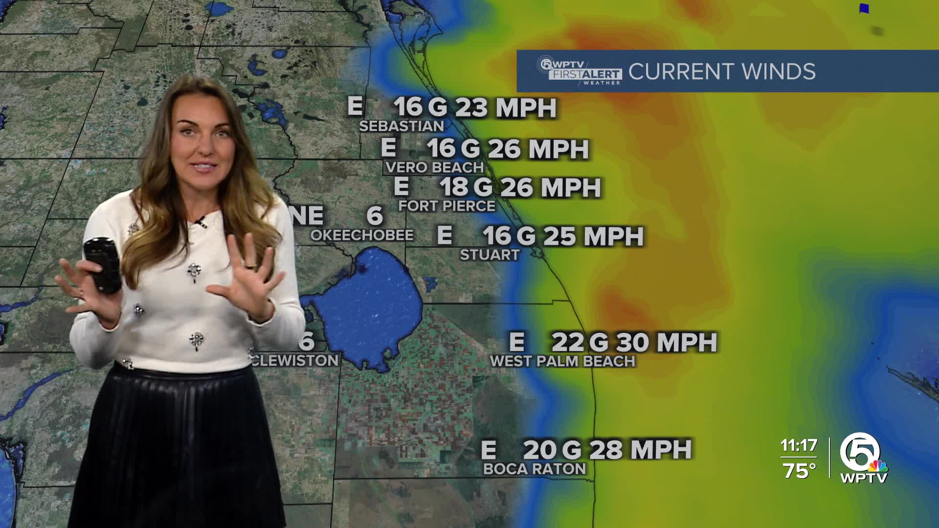
This pattern is currently bringing us gusty east-northeast winds, especially along the coast, with occasional gusts near 30 mph through early Tuesday.
While it won't be quite as windy inland, it may still be a good idea to secure loose outdoor items. Along with the breeze, a few quick, light showers may move in off the ocean, mainly along the east coast late Monday through Tuesday morning, but rain chances will stay low and brief.
With the strong onshore winds, the rip current threat will be stay high for beachgoers and a small craft advisory for boaters on through Tuesday evening.
Temperatures will remain comfortable and seasonable, with highs in the upper 70s with comfortable humidity. The breeze will keep afternoons feeling pleasant and cooler, making it a great stretch of weather for outdoor activities like beach walks, biking, or enjoying holiday events.
The only caveat to this will be a slight chance for mainly coastal showers.
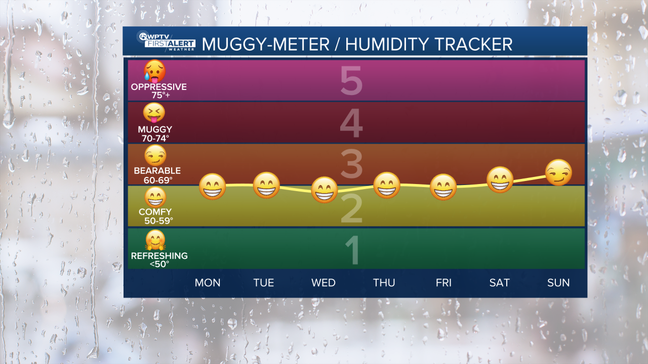
As we head into late Tuesday and Wednesday, winds will gradually ease but stay easterly, conditions will remain mostly dry, and mornings will be cool—ranging from the upper 50s to upper 60s— while the afternoon will stay warm and enjoyable, reaching upper 70s to near 80 through Friday.
The weekend continues to be pleasant with highs near 80, lows in the 60s, and sunny skies.
**Portions of this story were assisted by artificial intelligence tools and reviewed by a WPTV journalist to ensure accuracy, clarity, and adherence to editorial standards.


