
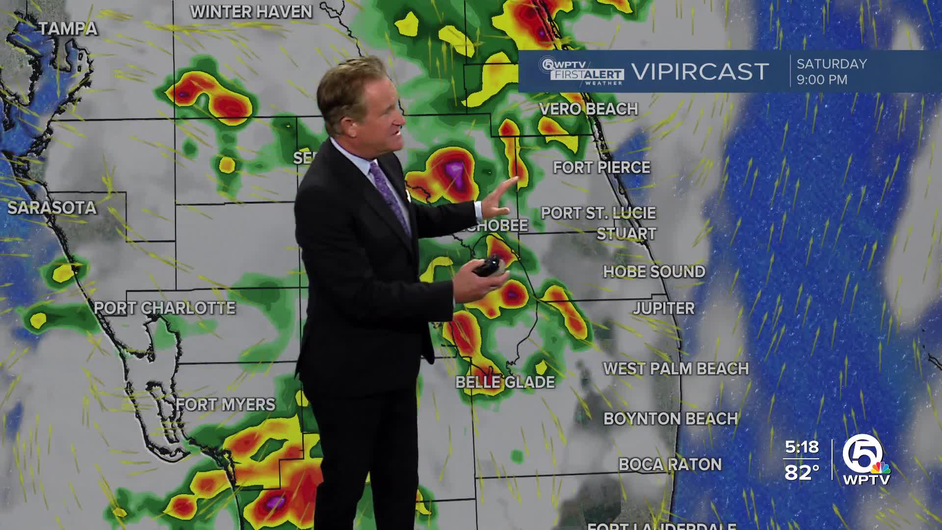


WEST PALM BEACH, Fla. — We are tracking storms this afternoon and evening, some of which could be strong. Most of our area is under a Level 1 marginal risk for severe weather with gusty winds and small hail.
MORE WEATHER: Radar | Alerts | 7-Day Forecast | Hourly Forecast
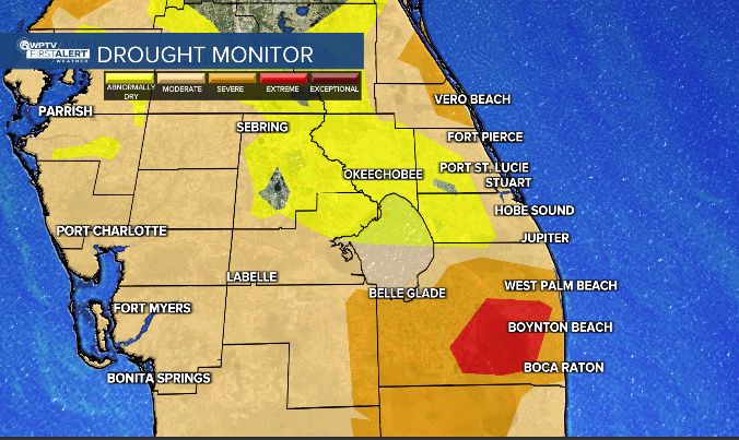
With slow moving storms, isolated flooding is possible in poor drainage areas. This is helping to bring in much-needed rain as parts of our area, especially Palm Beach County, are back in extreme drought.
The last of the storms will move out of here by 7-8 p.m. Lows will fall into the mid-upper 70s overnight.
Saharan dust is building in and decreasing rain chances this weekend. Even with the sunshine out, it will be hazy. Expect a 40% chance of showers this weekend, mainly during the afternoon and early evening.
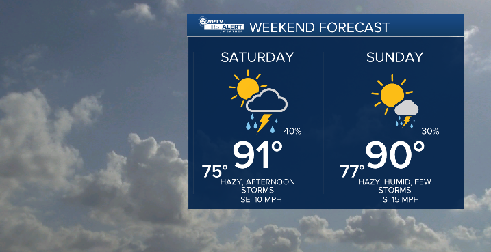
Daytime highs will continue to sit near average this weekend, around 90 degrees.
By the start of next week, we will start to see those coastal morning showers with inland afternoon showers again.
Showers and thunderstorms associated with low pressure over the Yucatan Peninsula will push into the Bay of Campeche this weekend.
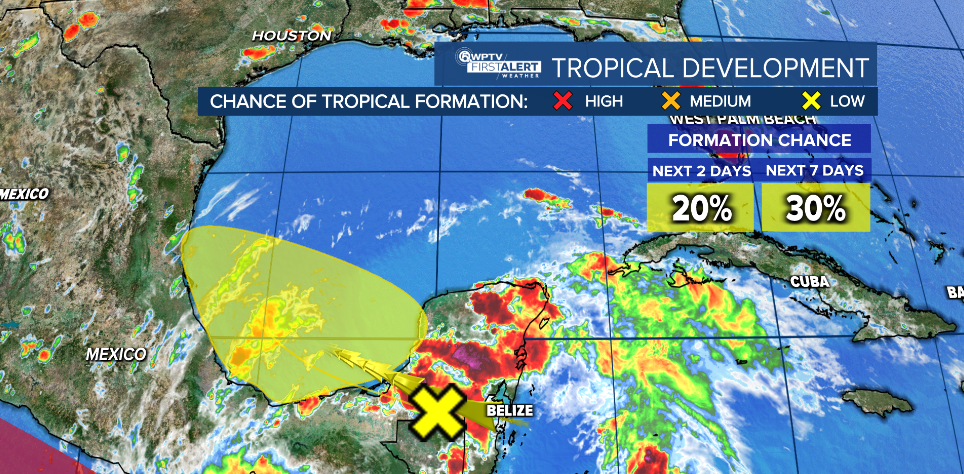
There is a small chance for tropical development before it pushes inland over Mexico.


