


WEST PALM BEACH, Fla. — Unsettled weather will stick around through Monday, bringing several rounds of showers and thunderstorms to the Treasure Coast and Palm Beaches.
A few, lingering showers are possible overnight— otherwise it stays mainly cloudy and muggy with lows in the mid 60s inland-lower 70s by the coast.
MORE WEATHER: Radar | Alerts | 7-Day Forecast | Hourly Forecast
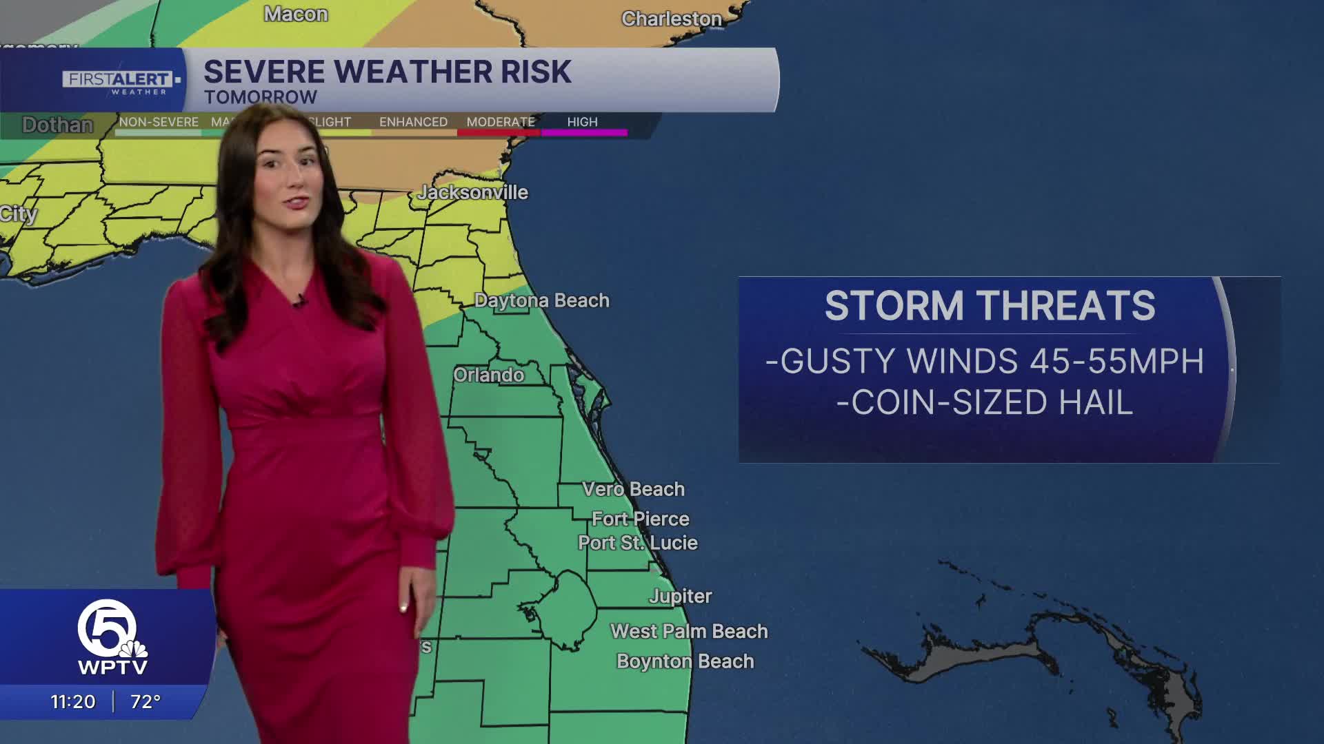
Another round of unstable weather is expected Monday ahead of our next cold front. The day starts off dry with mostly cloudy skies. Southerly winds will pick up in the late morning ahead of the front. Highs will still make it into the mid 80s with some inland spots reaching for 90.

The first storms look to arrive first in south Palm Beach County during the early afternoon before spreading north. Some storms have the potential to turn strong, producing wind gusts around 60 mph and near quarter-sized hail.
Areas that see repeated rounds of heavy rainfall may see some localized flooding.
Once the front moves through, a noticeable change arrives Tuesday morning with chillier temperatures. Parts of the Treasure Coast and Okeechobee County will wake up to the lower 50s. Highs will drop below average, struggling to make it into the 70s on Tuesday and Wednesday.

The rest of the week stays breezy and mostly cloudy. Rain chances will be much lower, but not 0.
Boating and beach hazards remain with a small craft advisory in effect Monday for coastal waters and a high rip current risk for our beaches.


