


WEST PALM BEACH, Fla. — Sunday will feel unusually warm for January. Strengthening southerly winds will push temperatures even higher, with highs climbing into the mid to upper 80s for most inland areas and lower to mid 80s along the immediate coast.
Several locations, especially away from the ocean, may approach daily record highs. The January 25th record highs are 87 in West Palm Beach, 86 in Fort Pierce, and 86 in Vero Beach.
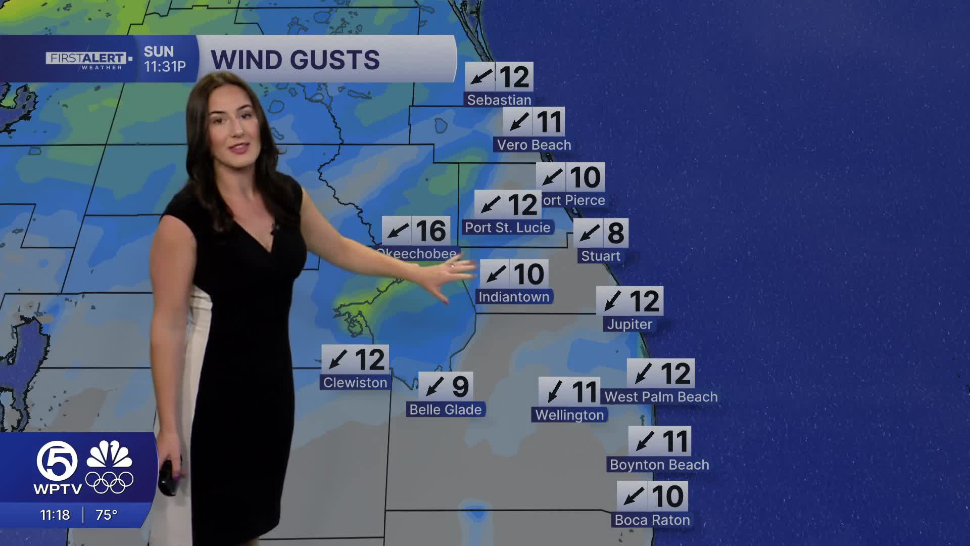
Gusty winds will develop during the afternoon, with occasional gusts up to 25 mph.
MORE WEATHER: Radar | Alerts | 7-Day Forecast | Hourly Forecast
While the weather will look inviting, ocean conditions will not be. A moderate to high risk of rip currents continues at all Atlantic beaches through the weekend. Swimming is discouraged due to the strong currents.
Late Sunday night into Monday, a strong cold front will move through the region. Scattered showers are expected Monday morning, especially in the Treasure Coast. No thunderstorms are expected. Winds will shift to the northwest behind the front and increase, ushering in much cooler air.
By Monday afternoon, temperatures will vary across the viewing area. Highs will reach the upper mid 70s across the Treasure Coast, while the Palm Beaches warm to the lower 80s before cooler air fully settles in.
The cold air arrives Monday night into Tuesday morning.
High pressure will keep conditions dry through the middle of next week, but temperatures will remain well below normal. Afternoon highs Tuesday will only reach the middle to upper 60s across the region. Another reinforcing cold front later in the week could extend the cold stretch, with several mornings featuring chilly temperatures in the 40s and a continued concern for near-freezing conditions inland.


