


WEST PALM BEACH, Fla. — A strong cold front will sweep across the state early Monday. Behind it, temperatures will drop sharply— bringing the coldest air we’ve seen since March.
MORE WEATHER: Radar | Alerts | 7-Day Forecast | Hourly Forecast
You will start to notice a change in the air Monday first in the Treasure Coast before sweeping southward. Winds turn out of the north behind the front, picking up to 15 mph with higher gusts.

Highs will reach for the upper 70s, nearly 10 degrees cooler than Sunday. However, the big change will arrive as you sleep.
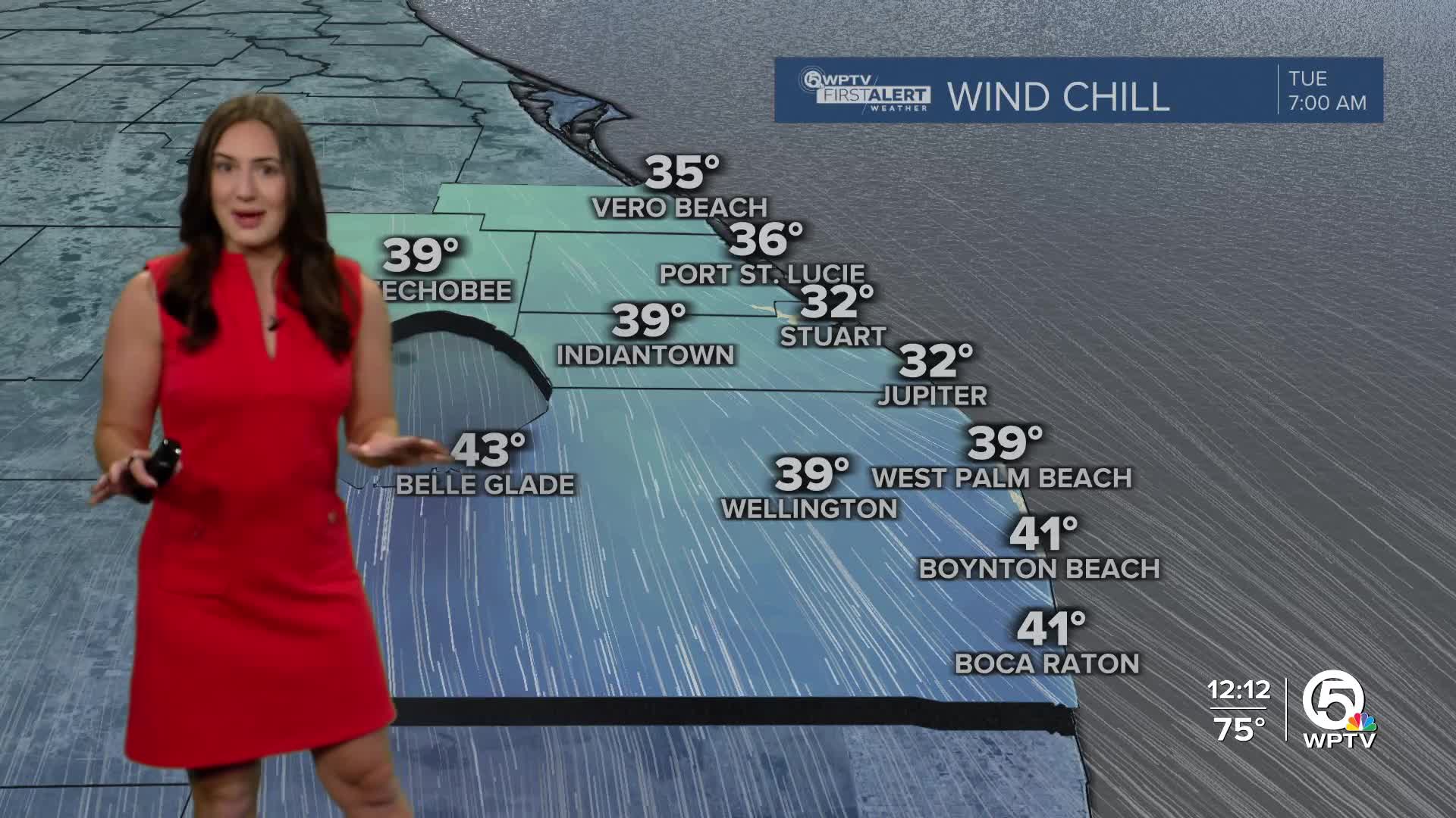
Monday night into Tuesday morning, temperatures are forecast to drop into the 40s.
Inland spots could briefly dip near 40, while coastal areas may stay closer to the middle 40s. Wind chills could make it feel like the middle to upper 30s early Tuesday morning.
Afternoon highs on Veterans Day will only reach the mid to upper 60s, with breezy north winds keeping it feeling cool all day.
The cold, dry air settles in through midweek before a gradual warm-up begins. Highs return to the 70s by Wednesday and could reach the low 80s again by the end of the week.


