


WEST PALM BEACH, Fla. — Tonight stays on the chillier side, but not cold. Overnight lows settle back into the mid to upper 40s inland, with low to mid-50s closer to the coast. Clouds increase from north to south early in the morning ahead of our next cold front.
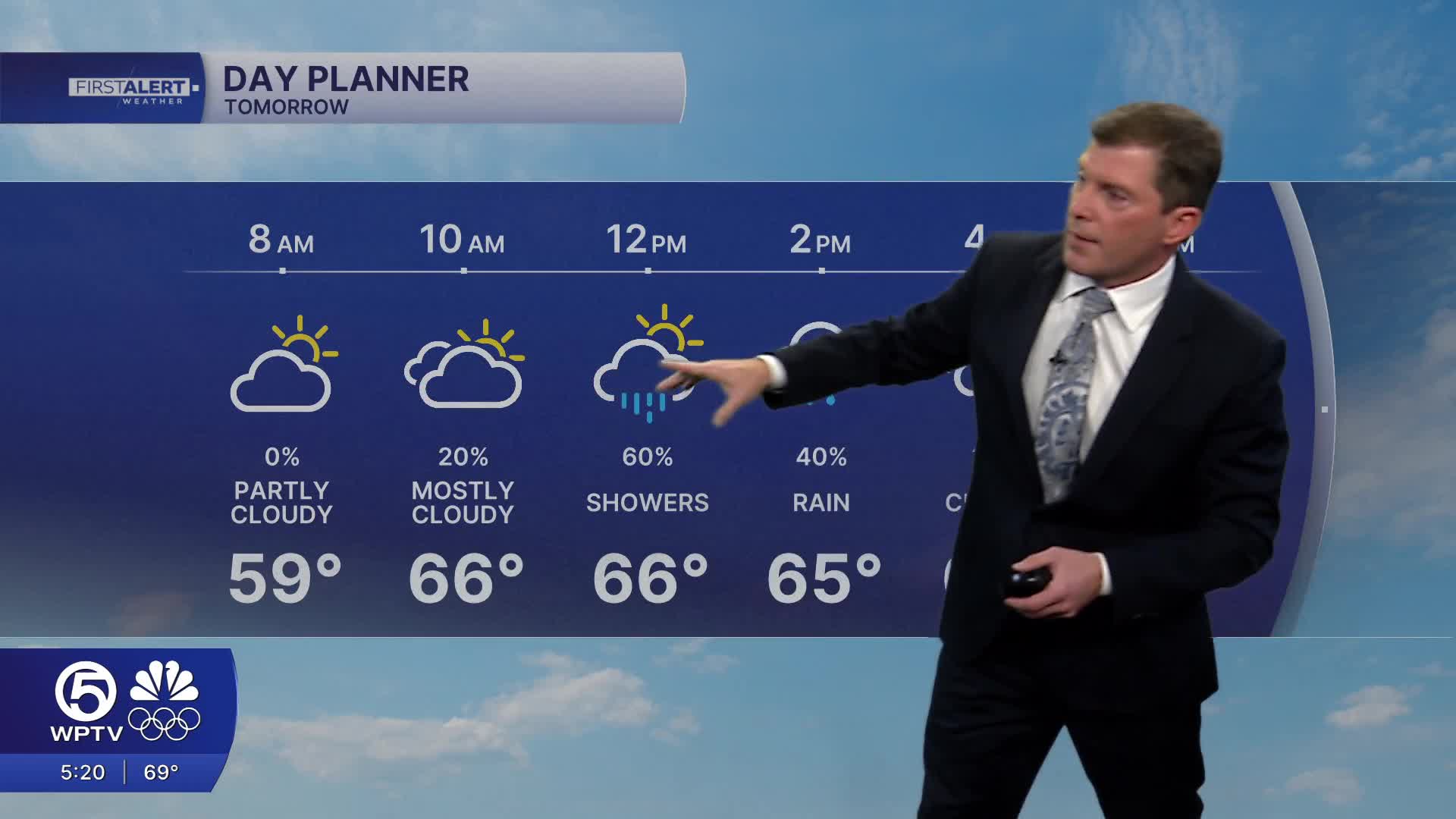
The front moves in Thursday, bringing a chance for a few passing showers. Rainfall looks light and spotty, with the highest accumulations near a 1/2 inch. No thunderstorms are expected. It will get breezy with occasional gusts up to 30 mph.
MORE WEATHER: Radar | Alerts | 7-Day Forecast | Hourly Forecast
Behind the cold front, chillier and drier air returns for the end of the workweek. Morning temperatures Friday drop back into the lower 40s for the Palm Beaches with the mid 30s to the north. The coldest inland spots could approach freezing. Friday will stay breezy with lots of sunshine. Afternoon highs will settle into the lower-mid 60s.
Boating conditions deteriorate again with the arrival of the front. A small craft advisory goes into effect Thursday, with offshore waters remaining hazardous through Saturday.
A high risk of rip currents continues along Atlantic beaches, including Palm Beach County. Swimmers should exercise caution and stay near lifeguards.
Dry weather continues into the weekend with near-normal highs (70s) and cooler nights. Another weak front will approach the area late in the weekend, but no significant changes are expected.


