


WEST PALM BEACH, Fla. — Quiet and warm weather continues across the Treasure Coast and Palm Beaches this weekend, but big changes are on the way.
Watch out for early-morning fog on Sunday. Light winds, clear skies, and lingering moisture will allow patchy to locally dense fog to form, especially inland and west of I-95. Visibility could be very low and drop below a mile at times around sunrise.
MORE WEATHER: Radar | Alerts | 7-Day Forecast | Hourly Forecast
Sunday afternoon will be pleasant and dry. Expect partly cloudy skies with highs in the upper 70s to near 80 degrees, a few degrees above average for late December. Coastal areas may be slightly cooler thanks to afternoon sea breezes.
While it is perfect beach weather, watch for rip currents as they are high along the Treasure Coast.
A strong cold front will move through early next week, likely late Monday night into Tuesday. While rain chances remain low, temperatures will drop sharply behind the front.
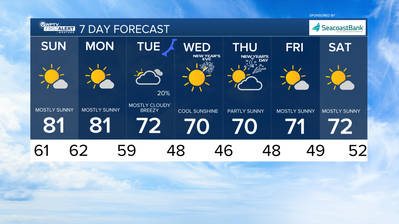
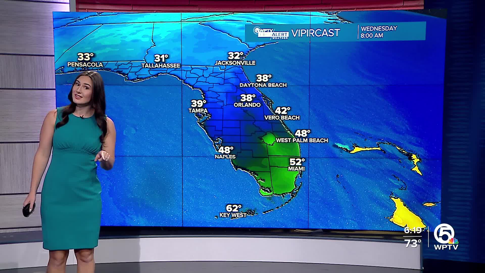
Weather models have been consecutively showing colder air arriving mid-week. Overnight lows will be in the 30s for interior locations and mid-upper 40s near the coast as we head into the New Year.
This much cooler, drier air looks to stick around through the end of the week with highs struggling to get out of the 60s.


