


WEST PALM BEACH, Fla. — South Florida is heading into a turbulent stretch of weather this weekend as a cold front moves through the region, bringing strengthening winds, periods of rain, and increasingly dangerous ocean conditions.
Behind the front, winds will quickly pick up and become a major concern, especially along the east coast. Saturday night into Sunday, sustained winds are expected to reach 15-25 miles per hour, with gusts nearing 40 miles per hour at times. The strongest winds are expected along coastal communities.
A Wind Advisory has been issued for the Treasure Coast through 4 PM Sunday. The gusty winds will blow around unsecured objects and tree limbs could be blown down.
MORE WEATHER: Radar | Alerts | 7-Day Forecast | Hourly Forecast
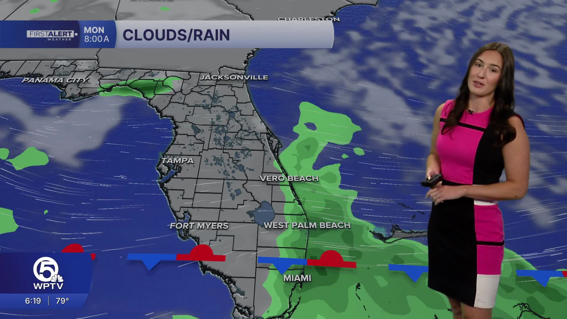
In addition to the gusty winds, downpours and thunderstorms are developing inland this afternoon as moisture increases ahead of the front. While widespread severe weather is not expected, some storms could produce brief heavy downpours.
Rain will become more likely as we head into Sunday. Repeated rounds of showers may lead to localized street flooding in some urban areas. Rainfall totals could reach one to two inches in isolated spots.
The winds will also create dangerous conditions at the beaches and on the water. Wave heights in the Atlantic are forecast to build rapidly, reaching 10 feet or higher overnight and into Sunday.
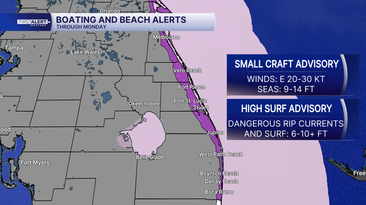
A high risk of rip currents will expand along the entire east coast of South Florida, and hazardous surf conditions are expected to persist into early next week. Boating conditions will deteriorate as well, with advisories in effect as seas and winds increase.
Temperatures will remain warm ahead of the front, with highs reaching the mid to upper 80s on Saturday. Conditions will turn slightly cooler on Sunday, with afternoon highs dropping into the 70s along the east coast and low 80s farther inland.
Looking ahead, breezy conditions are expected to continue into early next week, with a chance for lingering showers on Monday. Temperatures will gradually warm back into the 80s by the middle of the week.


