


WEST PALM BEACH, Fla. — Tonight will be comfortably cool after the sun goes down. By morning, lows will fall into the upper 50s around the lake, near 60 along the Treasure Coast and the mid 60s for the Palm Beaches.
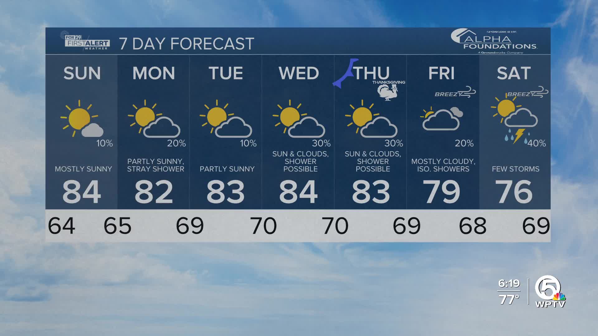
Sunday will be mostly sunny with some clouds building in late in the day as a weak front slides into north/central Florida. The front loses most of its punch before it reaches our area. Rain chances stay very low, with only a stray shower possible north of our region.
Winds may briefly turn north or northwest, but cooler air won't make it this far south. Highs remain in the low to middle 80s.
For the start of the workweek, winds shift back onshore nudging moisture upward. A few isolated showers can't be ruled out on Monday. Temperatures dip a touch with highs in the lower 80s.

We gradually warm up to the middle 80s by Wednesday.
MORE WEATHER: Radar | Alerts | 7-Day Forecast | Hourly Forecast
A more powerful storm system developing over the Great Lakes will drag a stronger cold front down the peninsula sometime Thursday into Friday.
On Thanksgiving, temperatures are still unseasonably warm in the lower 80s, but rain chances start to increase. Temperatures fall behind the cold front into the 70s for Friday. We will be tracking scattered showers and the possibility for a few thunderstorms through the holiday weekend.


