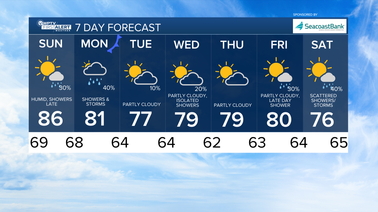


WEST PALM BEACH, Fla. — The weekend as a whole stays very warm and mainly sunny across the Treasure Coast and Palm Beaches. However, changes are in the works starting late Sunday.
Fog is once again possible overnight and through Sunday morning for inland areas and along the Treasure Coast. The fog will lift by mid-morning giving way to a partly sunny sky.
MORE WEATHER: Radar | Alerts | 7-Day Forecast | Hourly Forecast
A stalled front over north-central Florida continues to funnel a southerly to southwesterly breeze into our area, allowing temperatures to run several degrees above normal.
Afternoon highs climb into the mid 80s Sunday, feeling more like late October than early December.
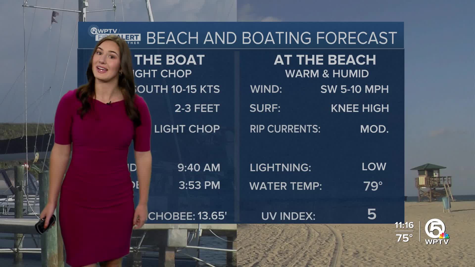
Marine conditions remain favorable heading into the weekend with light to moderate southerly to southwesterly winds and seas of 1 to 3 feet.
Changes arrive late Sunday into Monday as that front finally begins to push south. Moisture increases ahead of it, bringing a better chance for scattered showers and an isolated storm.
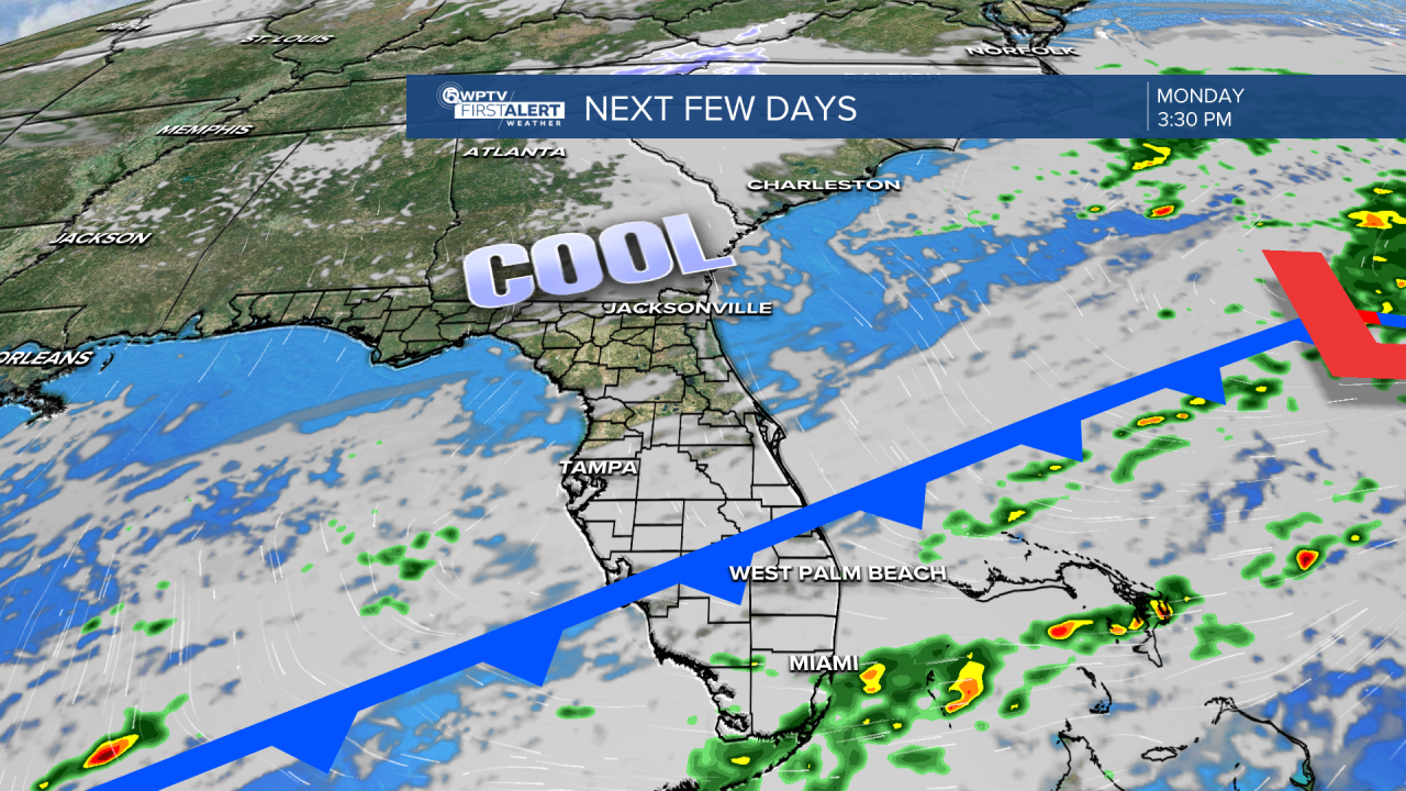
Behind the front, cooler and drier air settles in, dropping highs back into the mid and upper 70s Tuesday through Thursday. Overnight lows will also trend cooler, falling into the 50s and low 60s area-wide.
A stretch of quiet, comfortable weather returns Tuesday through Thursday as high pressure builds, keeping skies mostly clear and temperatures near seasonal averages.