

WEST PALM BEACH, Fla. — The National Oceanic and Atmospheric Administration (NOAA) is closely monitoring the tropics, not for hurricanes just yet, but for a climate pattern that could play a big role in the months ahead.
WATCH:
NOAA’s Climate Prediction Center has officially issued an El Niño Watch, signaling that conditions are becoming favorable for the development of El Niño later this year.
An El Niño Watch does not mean El Niño is here yet. Instead, it’s an early heads-up that the atmosphere and ocean are beginning to align in a way that could lead to its formation within the next several months.
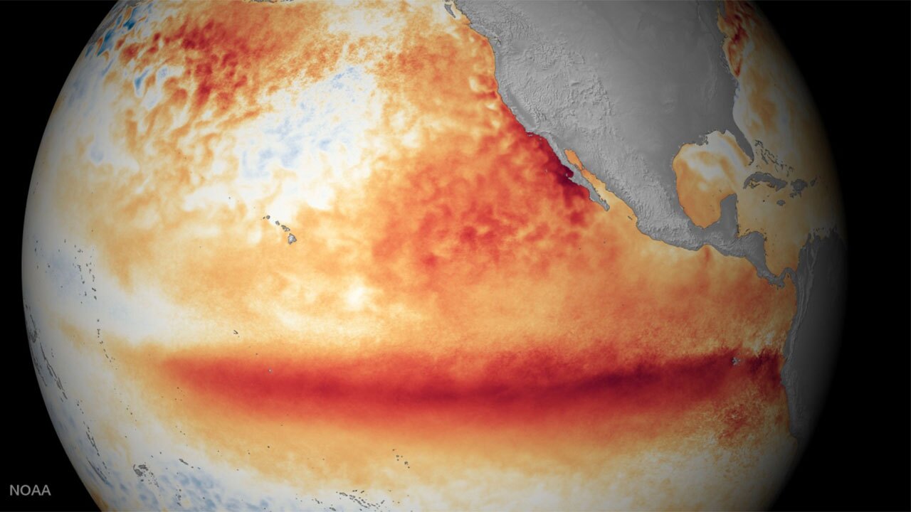
According to NOAA’s Climate Prediction Center, there is a 62% chance that El Niño develops between June and August as the Pacific transitions away from La Niña and into a more neutral pattern this spring.
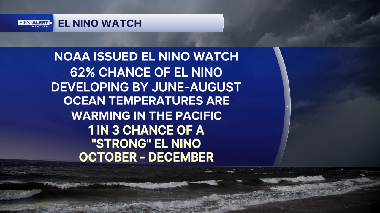
Right now, the Pacific Ocean is transitioning out of La Niña, with forecasters expecting a period of neutral conditions this spring before potentially shifting into El Niño by summer or fall.
For those of us along Florida’s east coast and across the Treasure Coast and Palm Beaches, this development could actually be welcomed news ahead of the Atlantic hurricane season.
One of the biggest impacts of El Niño is an increase in upper-level winds across the Caribbean and tropical Atlantic, which is called wind shear.
In other words, El Niño can act like a natural barrier, helping to prevent storms from forming or intensifying as they move west toward the Caribbean and the U.S.
Even if El Niño does form, the potential strength remains very uncertain, with about a one-in-three chance that it reaches “strong” levels during the October through December time frame.
While this pattern can act as a natural suppressor of tropical activity, it is not a guarantee of a quiet season. The timing of El Niño’s development plays a critical role, and it only takes one storm to make an impact locally. Still, the current outlook suggests the environment could become less favorable for widespread tropical development if El Niño takes hold during the peak of the season.
As we move through the spring, forecasters will continue to monitor changes in the Pacific closely, as this time of year is known for lower confidence in long-range predictions. For now, NOAA’s El Niño Watch offers an early and potentially reassuring signal that could influence the months ahead.


