


TALLAHASSEE, Fla. — Florida Gov. Ron DeSantis on Tuesday issued a state of emergency for 49 counties as severe weather and tornadoes hammer parts of the state.
A majority of the dozens of counties under the state of emergency are in North Florida, while none from the Treasure Coast or South Florida are included.
The state of emergency would allow Florida to receive federal assistance and resources in the event of major damage.
The counties included under the order are Alachua, Baker, Bay, Bradford, Brevard, Calhoun, Citrus, Clay, Columbia, Dixie, Duval, Escambia, Flagler, Franklin, Gadsden, Gilchrist, Gulf, Hamilton, Hernando, Hillsborough, Holmes, Jackson, Jefferson, Lafayette, Lake, Leon, Levy, Liberty, Madison, Marion, Nassau, Okaloosa, Orange, Osceola, Pasco, Pinellas, Polk, Putnam, Santa Rosa, Seminole, Sumter, St. Johns, Suwannee, Taylor, Union, Volusia, Wakulla, Walton and Washington.
DeSantis on Monday activated the Florida State Guard to respond to any weather-related emergencies.
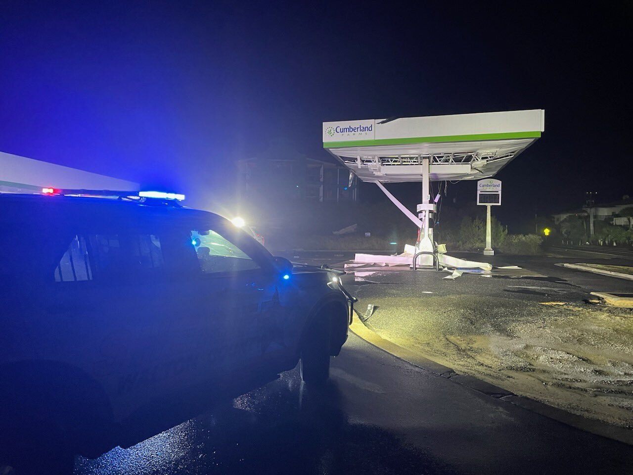
Parts of the Florida Panhandle on Tuesday have already sustained damage from tornadoes, blowing the roofs off homes and tossing furniture.
MORE WEATHER: Radar |Alerts | 7-Day Forecast | Hourly Forecast
Locally, the Storm Prediction Center has placed the entire Treasure Coast and Okeechobee County, as well as parts of Palm Beach County, under a "slight" risk of severe weather on Tuesday.

WPTV First Alert Weather meteorologist Steve Villanueva said scattered strong storms and some tornadoes are possible Tuesday evening. Damaging winds will be the biggest threat.
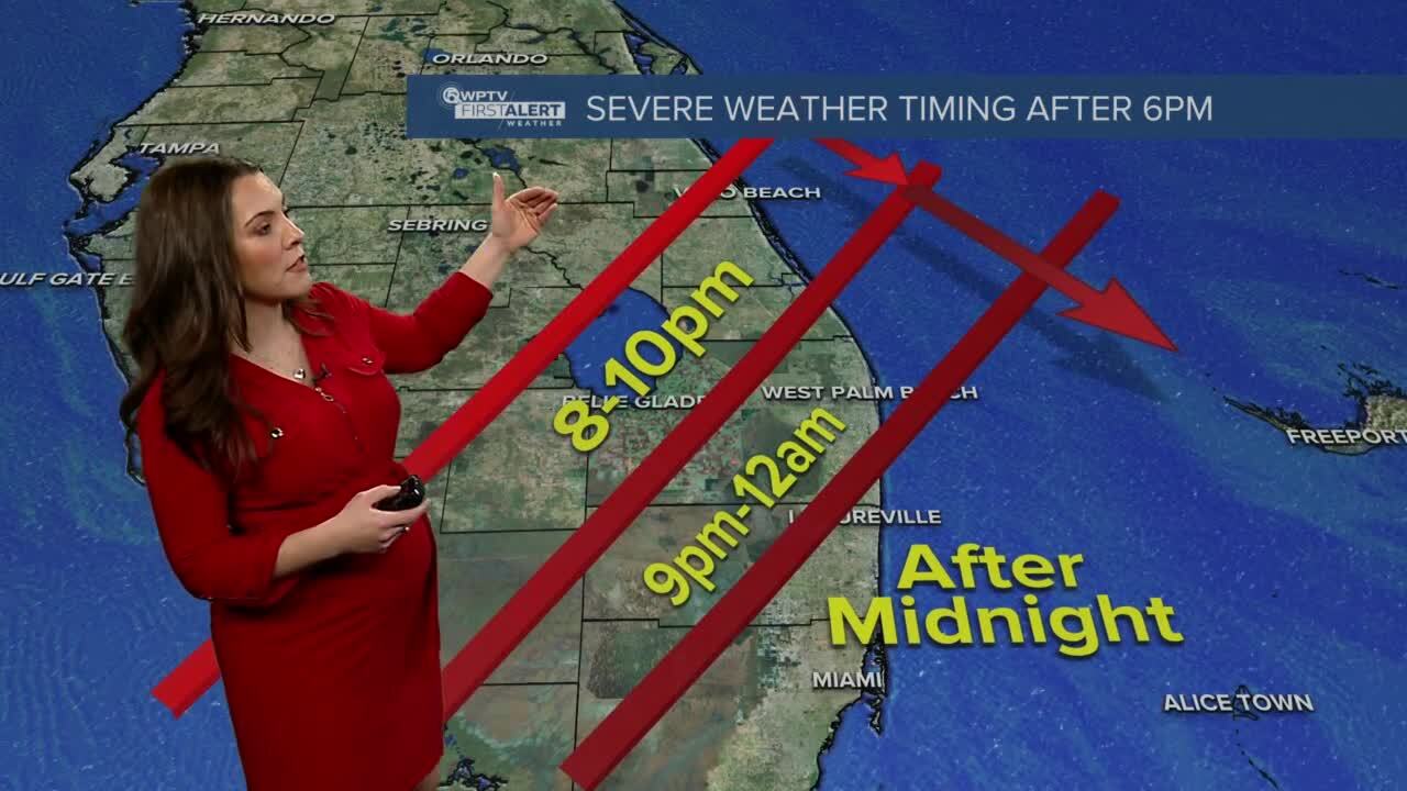
"It's going to be a nighttime event. After 6 p.m.," WPTV First Alert Weather meteorologist Jennifer Correa added. "It starts farther north. It works its way southward. After 6 until tonight, that's when you can expect the worst of the weather."
Impacts include damaging straight-line winds of 50 to 70 mph and isolated tornadoes.
Here is a breakdown of the timing of the unsettled weather:
- 6 p.m. to 8 p.m.: Isolated strong/severe storms ahead of the main line that could spawn a tornado or two
- 8 p.m. to 10 p.m.: A strong line of thunderstorms moves through the Treasure Coast
- 9 p.m. to 12 a.m.: Line moves through Palm Beach County
- 12 a.m. to 1 a.m.: Severe threat ends, partial clearing, and colder air moves in the rest of the night.
In general, the line will be weakening as it moves south and east, Correa said.
Once the storms clear, much cooler and drier air will push in behind the system for Wednesday.


