
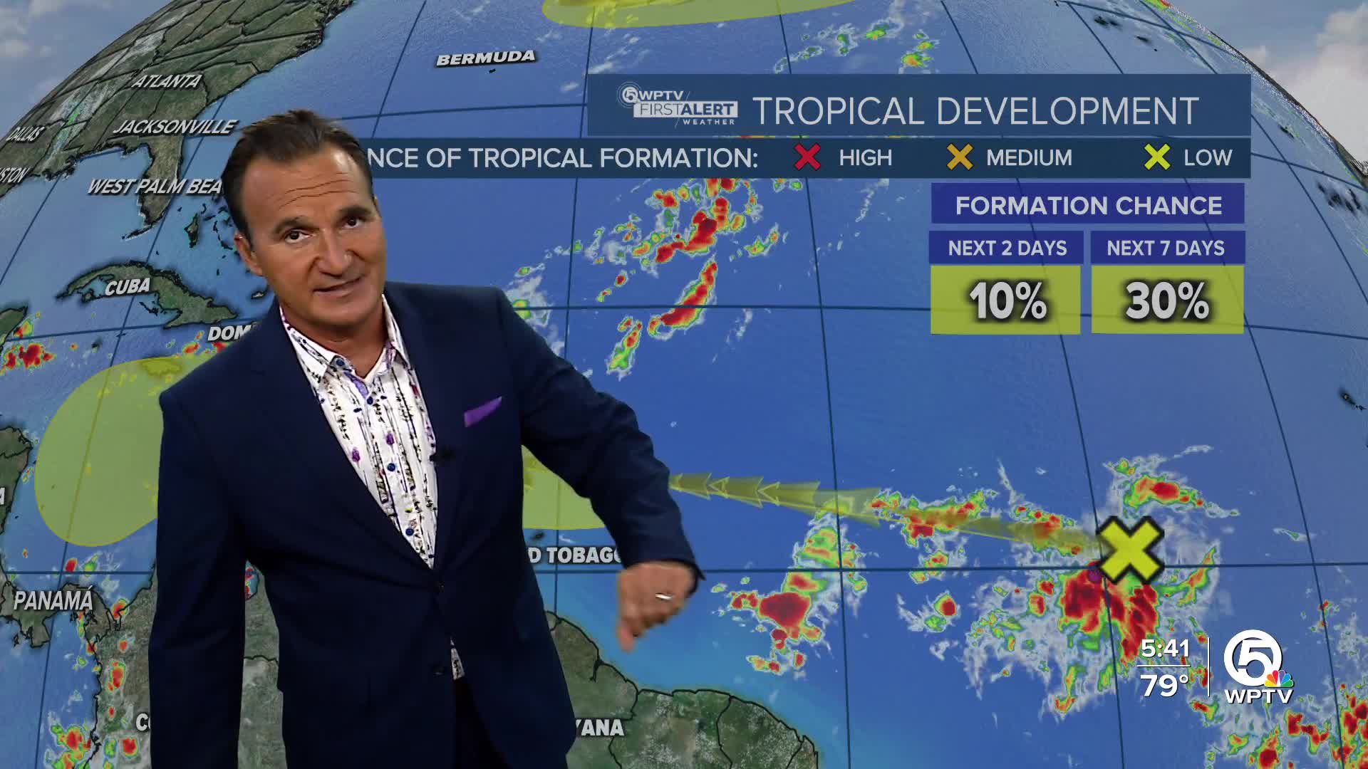


WEST PALM BEACH, Fla. — A tropical wave currently located over the central tropical Atlantic is generating a significant area of showers and thunderstorms.
This system is moving westward at a speed of 15 to 20 mph and may experience gradual development over the coming days once it enters the Caribbean, which is expected to occur around Tuesday or Wednesday of next week.

Regardless of its development, heavy rainfall and gusty winds are anticipated as the wave approaches the Windward Islands late this weekend, ultimately moving through the Caribbean Sea, where conditions will be favorable for more development and strengthening.
Currently, the formation chances are low, but that is expected to increase as the days progress.
In the North Atlantic, a non-tropical area of strong low pressure is forming several hundred miles south of Nova Scotia, Canada. This system is expected to move southeastward before turning northeastward by this weekend.

As it travels over the Gulf Stream northeast of Bermuda, there is potential for some subtropical or tropical development. However, as it moves into colder waters by early next week, the chances for further development will diminish.
The next named storm will be Melissa.
*Portions of this story were assisted by artificial intelligence tools and reviewed by a WPTV journalist to ensure accuracy, clarity, and adherence to editorial standards.
TRACKING THE TROPICS: Hurricane Center | Hurricane Guide


