
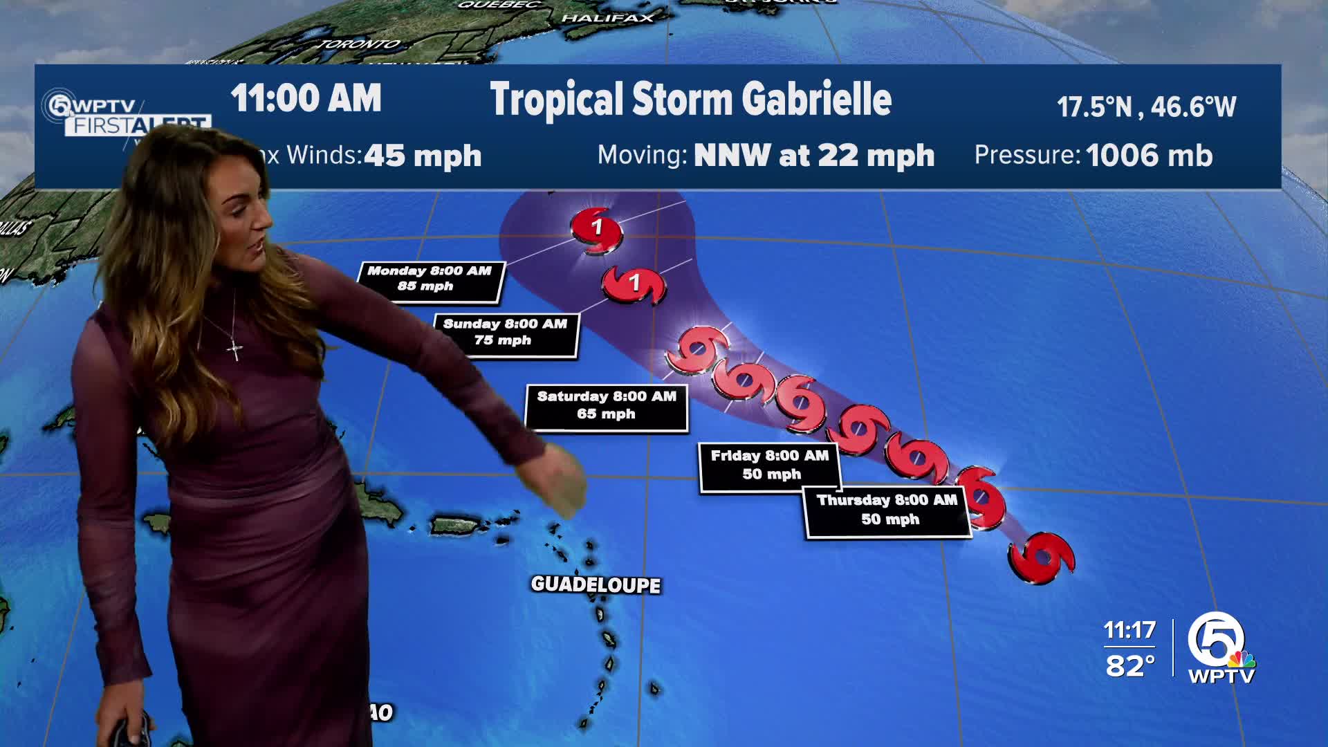


WEST PALM BEACH, Fla. — Satellite data confirms that a broad area of low pressure in the central Atlantic has strengthened into Tropical Storm Gabrielle after nearly three weeks without a named system in the Atlantic basin during what is typically the peak of hurricane season.
TRACKING THE TROPICS: Hurricane Center | Hurricane Guide
The system is located roughly halfway between the Cabo Verde Islands and the Windward Islands, moving northwest at about 14 mph with sustained winds of 50 mph. Forecasters expect a gradual turn toward the northwest over the next couple of days before it curves more west-northwest late this week. By the weekend, the system is expected to begin lifting northward, remaining well east of the Caribbean islands.
The National Hurricane Center (NHC) says there is high confidence that the depression will pass safely east of the Windward and Leeward Islands, but Bermuda may need to keep a close eye on its track in the coming days.

Currently, the storm is encountering wind shear and dry air, resulting in only slow strengthening in the short term. However, by the weekend, conditions are forecast to become more favorable for development, and the NHC expects the system could reach hurricane strength by early next week.
At this time, Tropical Depression Seven poses no threat to Florida or the U.S. East Coast.
WPTV will continue to track this system and bring you the latest updates on air, online, and inside our free WPTV Weather app.


