



WEST PALM BEACH, Fla. — We are closely monitoring a developing area of low pressure in the southwestern Gulf of America that has a high chance of becoming a tropical depression or tropical storm within the next 48 hours.
An elongated area of low pressure has developed near Mexico's Gulf Coast and is expected to gradually strengthen as it drifts east before turning north toward the U.S. Gulf Coast.
TRACKING THE TROPICS: Hurricane Center | Hurricane Guide

The National Hurricane Center is giving the system an 80% chance of development over the next two days.
While it's still too early to determine exactly how strong the system may become or where any direct impacts could occur, the good news for South Florida is that no direct threats are currently forecast.
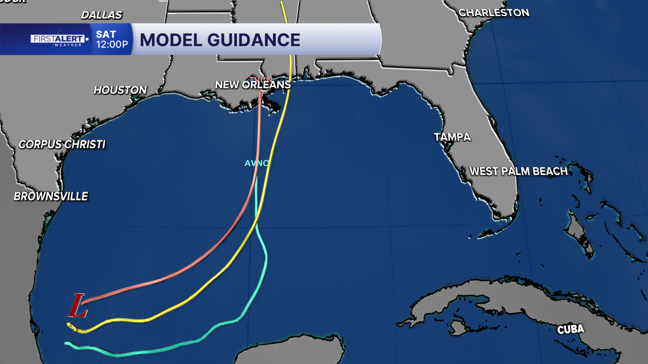
However, residents along the northern Gulf Coast, including Florida's Panhandle, should continue to monitor the system as its track and intensity become clearer in the coming days.
If the disturbance strengthens into a tropical storm, the next name on the Atlantic hurricane season list will be Isaias, pronounced ees-ah-EE-ahs.


