


WEST PALM BEACH, Fla. — The National Hurricane Center (NHC) is tracking a system in the central Atlantic that is producing a large area of disorganized showers and thunderstorms.
While dry air may limit development over the next day or so, conditions are expected to improve, and a tropical depression will likely form by the middle to latter part of the week.
TRACKING THE TROPICS: Hurricane Center | Hurricane Guide
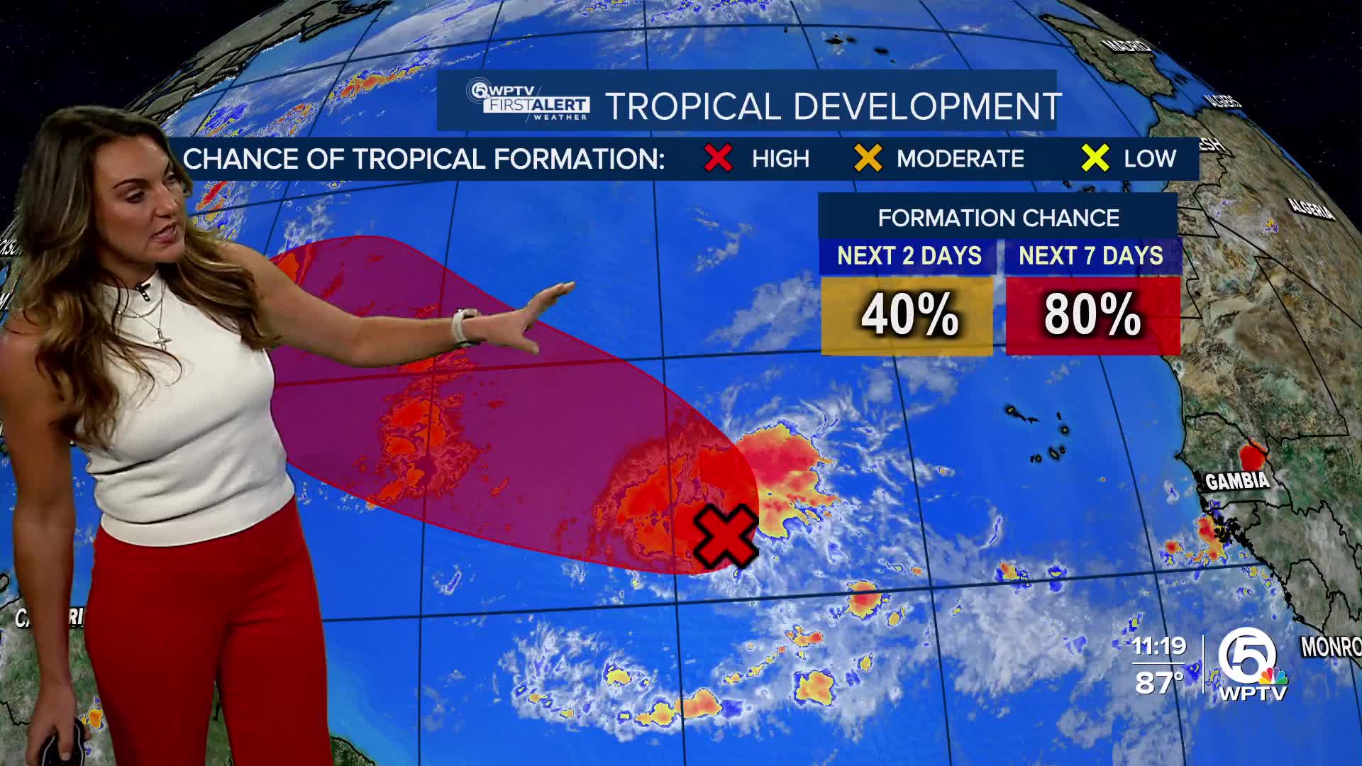
The system now has a 40% chance of development in the next two days and an 80% chance within the next seven days.
If it becomes a tropical storm, the next name on the list is Gabrielle.

The system is moving west-northwest at 10 to 15 mph.
Long-range forecast models, including the EURO and GFS, keep this system well offshore of the U.S. East Coast.
At this time, it does not pose a threat to Florida or the rest of the U.S., but Bermuda should continue to monitor closely as the system may turn north toward the island.

Hurricane


