
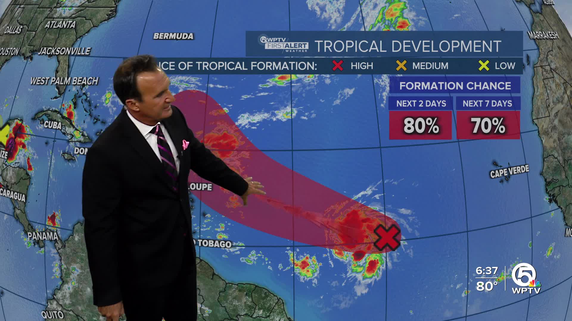


WEST PALM BEACH, Fla. — An area of low pressure, approximately 1,500 miles east of the Windward Islands, is becoming more organized, with satellite data indicating that it's strengthening. Conditions in the atmosphere are favorable for further development, and it’s likely this system will become a tropical depression—or possibly a tropical storm—within the next day or so.

It’s moving quickly toward the west-northwest and is expected to approach or pass just north of the northern Leeward Islands on Thursday and Friday. People in those areas should keep an eye on updates. The chances of development are high, with an 80% chance over the next 48 hours and a 90% chance within the next week.

Meanwhile, in the southwestern Gulf of Mexico, a separate area of low pressure near the Yucatán Peninsula is producing widespread showers and storms over parts of northern Guatemala, southeastern Mexico, and nearby waters. This system is expected to move into the Bay of Campeche later today, and while it may slowly develop, it will likely move inland by midweek.

Regardless of whether it strengthens, heavy rain and gusty winds are expected across the Yucatán, Belize, and southern Mexico over the next few days.
TRACKING THE TROPICS: Hurricane Center | Hurricane Guide


