


WEST PALM BEACH, Fla. — We are continuing to monitor activity that's brewing in the tropics.
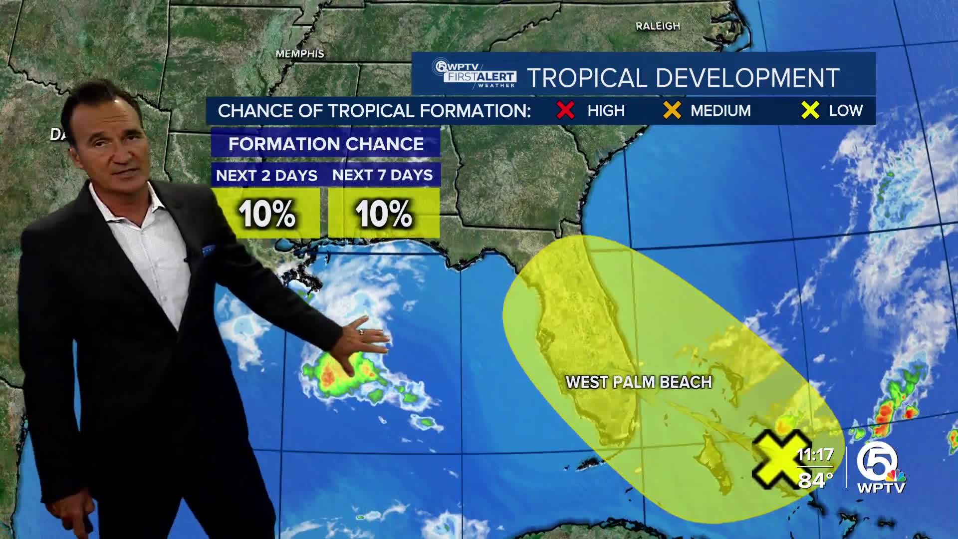
First, we are monitoring a potential area of low pressure that could form near the northwestern Bahamas and southern Florida over the next day or so. This system is associated with a lingering frontal boundary in the area. While any development is expected to be slow, the system is projected to drift northwestward—likely crossing the Florida Peninsula and eventually moving into the Gulf.

Meanwhile, farther out in the central tropical Atlantic, a tropical wave is set to roll off the coast of Africa within the next couple of days. Once it does, it’s expected to interact with another disturbance already in the eastern tropical Atlantic.
The system has a 40% chance of development. While it’s still early, there's a chance we could see some gradual development from this combined system as it makes its way west to west-northwest at around 15 to 20 mph.

It’s not time to worry just yet, but definitely a good time to stay informed as we watch how these systems evolve.
TRACKING THE TROPICS: Hurricane Center | Hurricane Guide


