


WEST PALM BEACH, Fla. — Satellite images reveal that Tropical Storm Lorenzo has developed some deep convection near its center, yet much of the thunderstorm activity is positioned to the east. While it may not appear very organized on conventional satellite views, microwave images reveal a small central core forming.
Current data indicates that Lorenzo is packing winds of about 50 knots and is moving northwest at 11 knots. This westward track is expected to continue overnight, but a turn to the north and northeast is anticipated as the storm picks up speed late Tuesday into Wednesday.
A significant update to note is that most forecasts now predict Lorenzo will turn east later this week and then southward, potentially getting trapped within the subtropical ridge. Expect a sharp hook toward the equator as we head into the weekend.
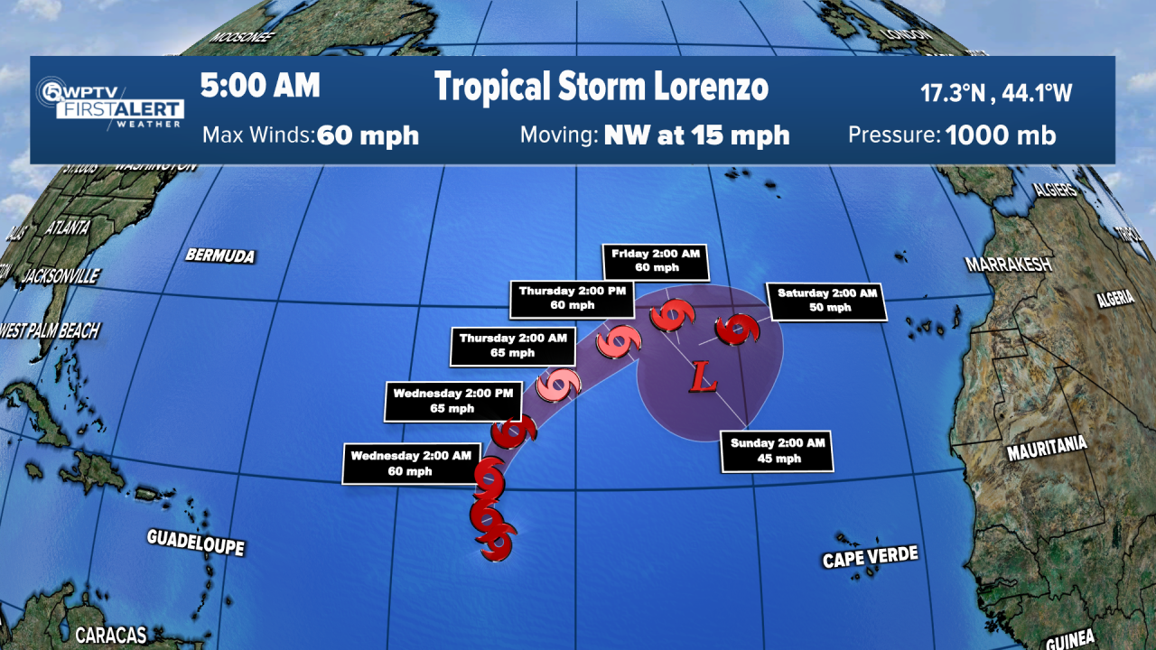
Forecasting Lorenzo’s intensity is tricky. An upper-level low currently affecting the storm is expected to move away, reducing shear in the coming days—conditions that usually favor strengthening. However, Lorenzo is also entering a region of dry air and will likely encounter the Saharan Air Layer, which could hinder its growth.
Some models suggest that it may weaken to a tropical depression, while others indicate the possibility of it becoming a Category 1 or 2 hurricane. The new forecast strikes a middle ground, predicting a bit more intensity than previous estimates. Keep in mind, though, that the forecast remains uncertain, as Lorenzo's small size makes it susceptible to rapid changes.
TRACKING THE TROPICS: Hurricane Center | Hurricane Guide
*Portions of this story were assisted by artificial intelligence tools and reviewed by a WPTV journalists to ensure accuracy, clarity, and adherence to editorial standards.


