
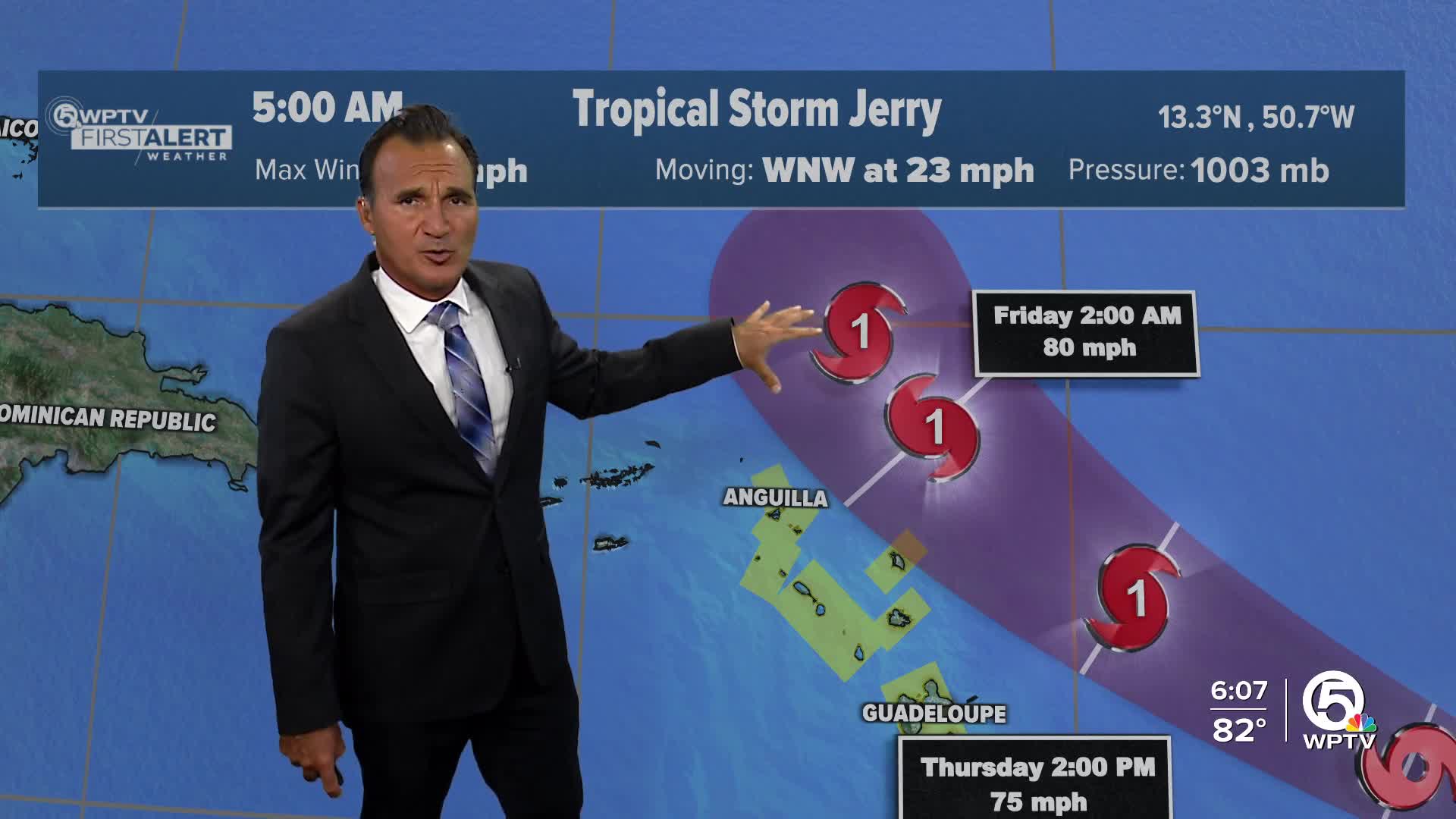


WEST PALM BEACH, Fla. — Tropical Storm Jerry is looking a bit disorganized today. Satellite pictures show a swirl of low clouds off to the northwest of its main thunderstorms, and wind measurements suggest its circulation is stretched out rather than tight.

Top winds are holding near 60 mph, and today both NOAA and Air Force Hurricane Hunters will head out to investigate the storm more closely.

The storm is moving quickly to the west-northwest at about 23 mph, steered by a strong high-pressure ridge to the north. This path puts the storm near or just north of the northern Leeward Islands late Thursday into Friday, slowing down a bit as it approaches.
Most forecast models agree on the general track, though a few lean a bit farther north or south. After passing the islands, Jerry should curve north and then northeast as a larger weather system over the U.S. and western Atlantic takes over.
The environment Jerry is in isn’t quite as favorable for rapid strengthening — wind shear and its current structure suggest a slower ramp-up. It’s still expected to eventually peak around 100 mph, but that may take longer than earlier thought.
A Tropical Storm Watch is now up for parts of the northern Leeward Islands. People there, as well as in the Virgin Islands and Puerto Rico, should be keeping tabs on Jerry. Heavy rain is likely on Thursday, with flash flooding possible, especially in higher terrain.
TRACKING THE TROPICS: Hurricane Center | Hurricane Guide


