
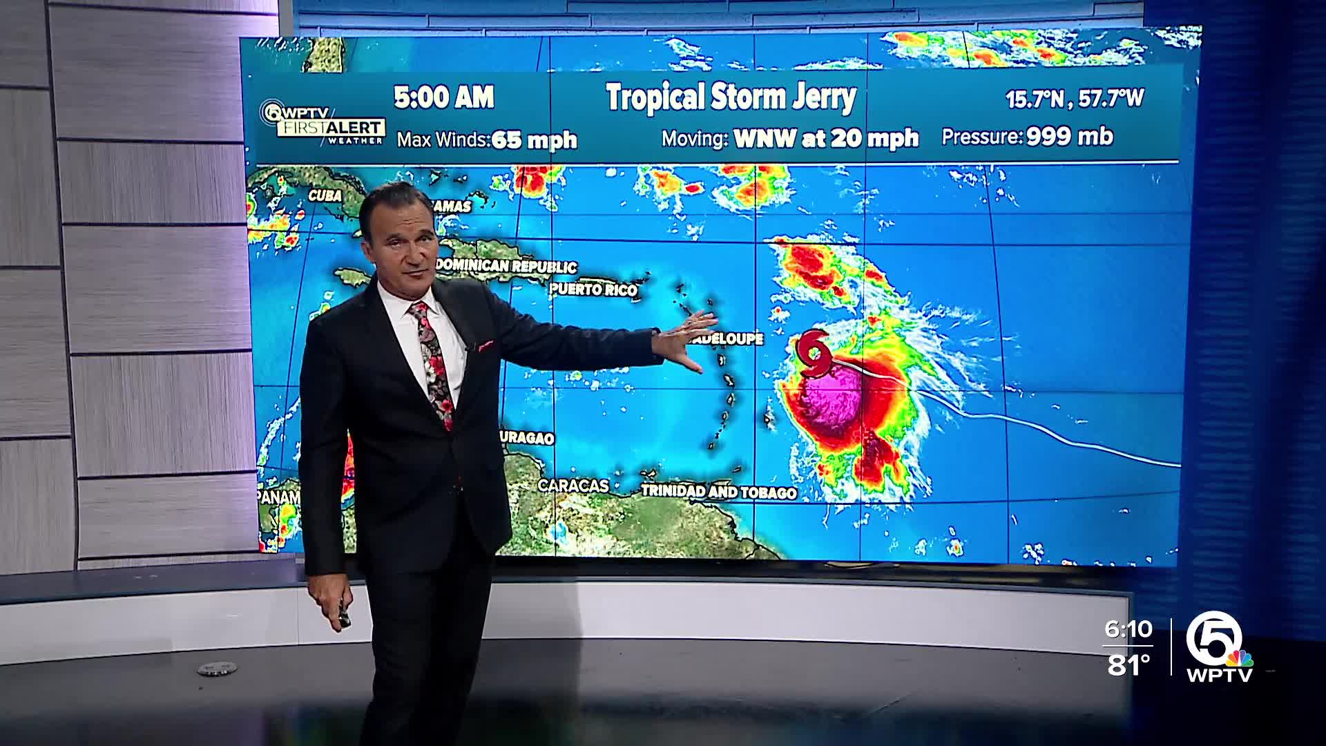


WEST PALM BEACH, Fla. — Tropical Storm Jerry is showing signs of strengthening tonight, with a large and powerful burst of thunderstorms developing near its center.
Satellite data shows extremely cold cloud tops—an indication of very strong storm activity—with frequent lightning. Meanwhile, Air Force hurricane hunters flying into the storm have found stronger winds than earlier estimates, confirming that Jerry’s maximum sustained winds are around 65 mph.

Jerry is currently moving quickly to the west-northwest and is expected to pass about 80 to 100 miles north of the northern Leeward Islands by late Thursday. While the core of the storm should stay offshore, tropical storm conditions—including gusty winds and heavy rain—are still possible in parts of the northern Leeward Islands, U.S. Virgin Islands, and British Virgin Islands. The rainfall could lead to flash flooding, especially in mountainous areas.

Despite facing wind shear—a condition that usually weakens storms—Jerry has managed to hold its strength and may even gradually intensify over the next few days as conditions become slightly more favorable. However, computer models disagree on how strong Jerry will get, with some showing it weakening and others forecasting a stronger storm. For now, the National Hurricane Center is going with a middle-ground forecast, expecting Jerry to slowly strengthen as it moves north of the islands.
Looking ahead, Jerry is expected to curve northward by the weekend and stay safely southeast of Bermuda, but forecasters caution that storm tracks can shift, and it’s a good idea to stay updated as the situation evolves.
TRACKING THE TROPICS: Hurricane Center | Hurricane Guide


