
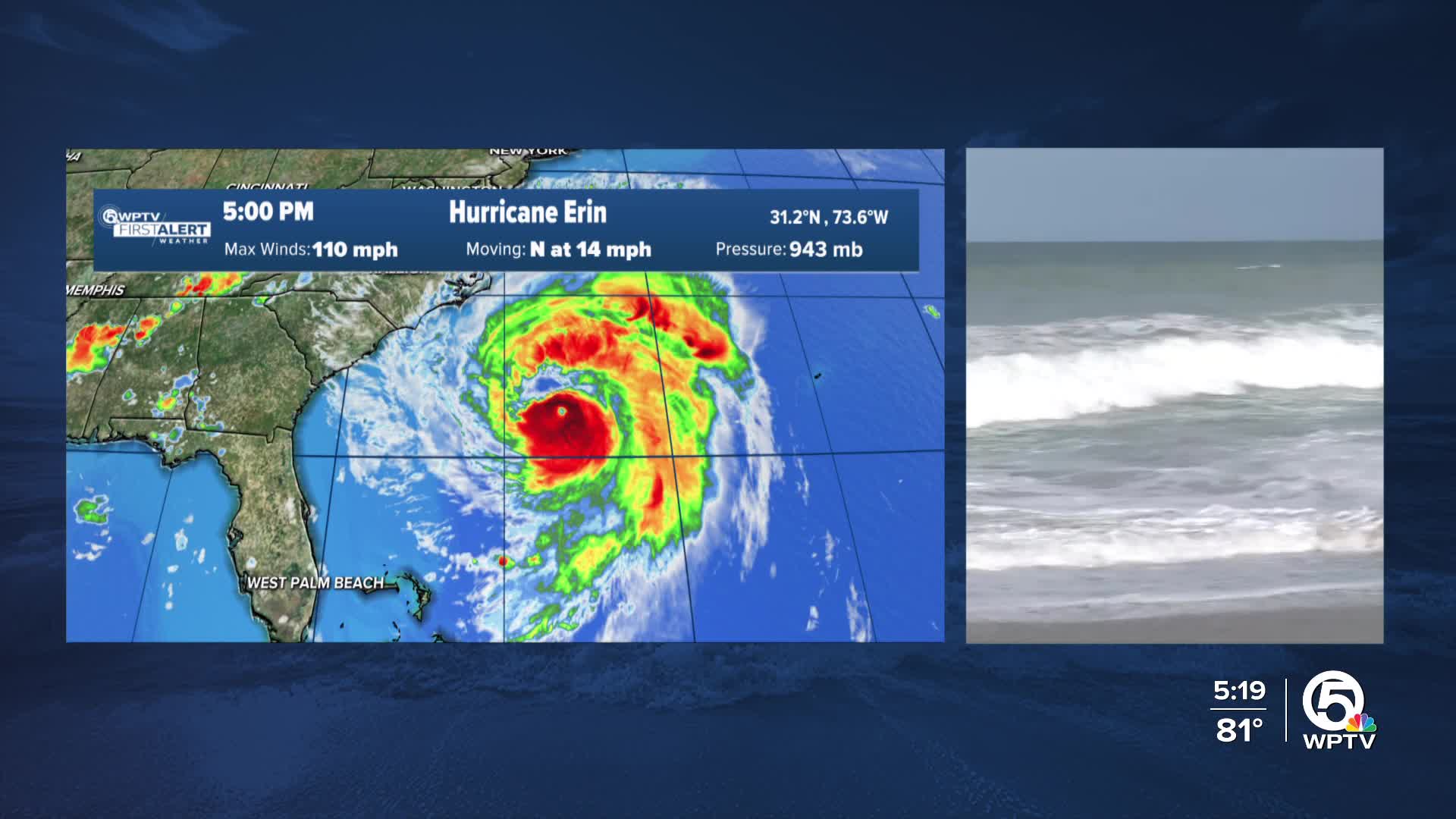


WEST PALM BEACH, Fla. — Hurricane Erin is continuing to travel north as a Category 2 storm with max sustained winds at 110 mph. This will bring it close enough to the Outer Banks and Bermuda to prompt tropical storm warnings and storm surge warnings.

While there will be no direct wind or weather impacts to Florida, we will see large swells move in through the rest of the week and only fading a little each day through the weekend. Peak wave heights will be 6-8 feet, and tides will be a little higher as well.

Generally, the largest waves will be north, decreasing in height as you go south toward southern Palm Beach County. We could see some beach erosion, dangerous surf and rip currents and dangerous boating around inlets and shoals.
A High Surf Advisory is in effect for the Treasure Coast and Palm Beaches. These dangerous rip currents will continue for the next few days into the weekend— swimming at the beach is not recommended.

TRACKING THE TROPICS: Hurricane Center | Hurricane Guide
The entire east coast of the U.S., including Florida, will see large swells impact the coast through the weekend, increasing rip currents and dangerous beach conditions through portions of the weekend. Beachgoers should follow advice from lifeguards, local authorities, and beach warning flags.
Another tropical wave moving through the Atlantic has increasing chances for development this week or the weekend. The National Hurricane System is giving this area a 70% chance of development as of Wednesday morning. It will continue to move across the tropical Atlantic and be north of the Caribbean islands around Friday before getting pulled northward. While it's still early, models are coming into agreement that this will go north as a weaker system.
Another wave around the Cabo Verde Islands now has a 40% chance of development. It is farther south and has a few days to develop before conditions become unfavorable.
It is a good time to review hurricane plans and make sure you're prepared as we head into the peak months of hurricane season.


