
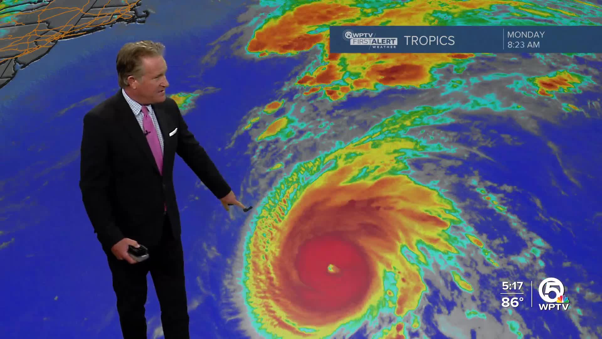


WEST PALM BEACH, Fla. — Hurricane Gabrielle strengthened to a Category 4 storm with winds of 140 mph on Monday evening, according to the National Hurricane Center.
The storm is moving toward the north-northeast at about 12 mph, followed by a faster northeastward or east-northeastward motion on Tuesday and Wednesday. On the forecast track, the center of Gabrielle is expected to pass east of Bermuda on Monday night.
TRACKING THE TROPICS: Hurricane Center | Hurricane Guide
Little significant change in strength is forecast for Monday night.
Hurricane-force winds extend outward up to 40 miles from the center and tropical-storm-force winds extend outward up to 140 miles.
By midweek, Gabrielle will encounter cooler waters and stronger wind shear, which should lead to weakening. The storm is expected to transition into an extra-tropical system by the end of the week.

Farther east, a tropical wave in the central Atlantic is producing limited showers and thunderstorms southwest of the Cabo Verde Islands. While dry air is keeping development low in the short term, conditions are expected to become more favorable by mid to late week.
The NHC says a tropical depression could form as the system tracks west-northwestward to northwestward across the open Atlantic. It has a 30% chance of development in the next two days, and a 80% chance through the next week.
Another tropical wave is moving quickly westward, located well to the east of the Lesser Antilles. Right now, showers and storms remain disorganized, but there is some potential for gradual development as the system moves toward the Caribbean later this week. Regardless of development, gusty winds and showers are expected to reach portions of the Leeward Islands late tonight into Tuesday. This system has a 10% chance of development in the next 48 hours and a 50% chance over the next week.


