
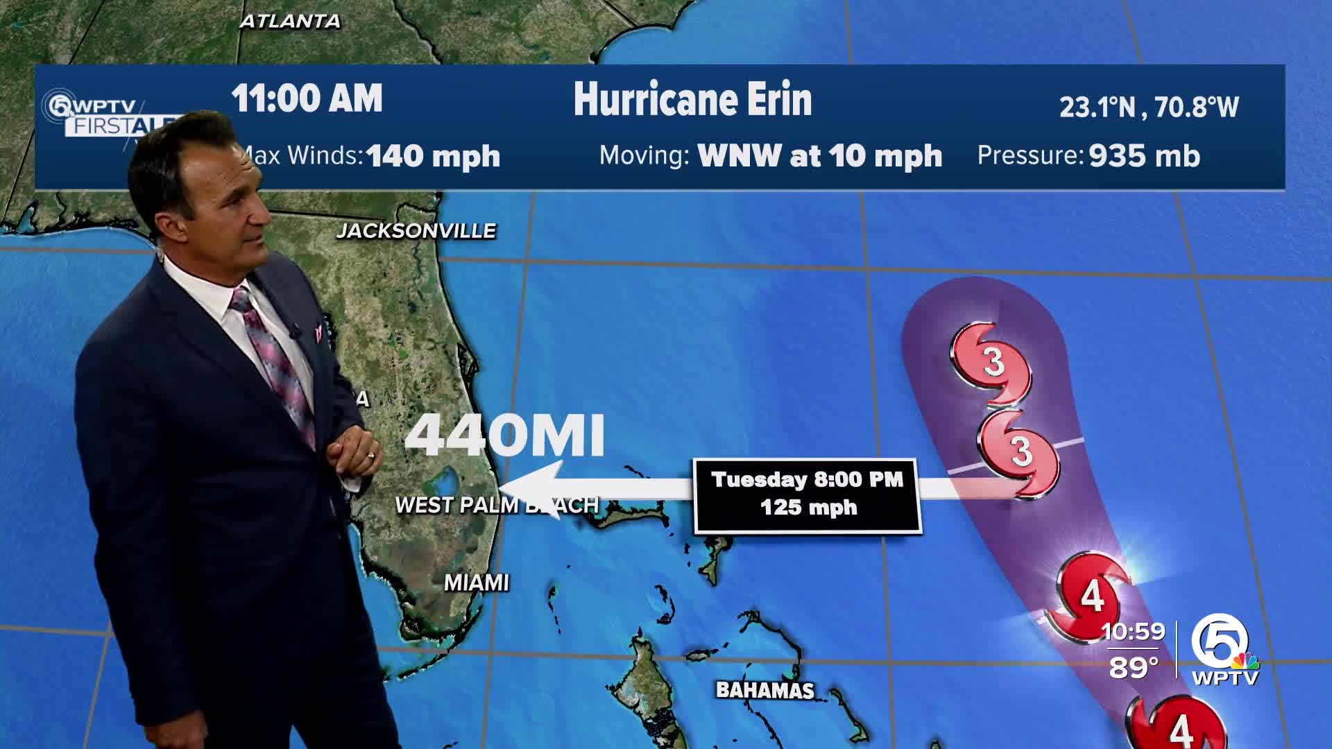


WEST PALM BEACH, Fla. — Hurricane Erin is a powerful Category 4 storm, having max sustained winds of 140 mph and moving west-northwest at 10 mph.
The Bahamas could feel some of those outer bands with tropical storm winds.
A Tropical Storm Warning is in effect for:
- Turks and Caicos Islands
- Southeast Bahamas
A Tropical Storm Watch is in effect for:
- Central Bahamas
Erin is expected to downgrade to a Category 3 tomorrow as it gradually turns north. It is still forecast to stay in open waters as it continues its track eventually to the northeast, over 400 miles away from the coast of Florida.

TRACKING THE TROPICS: Hurricane Center | Hurricane Guide
There will be no direct impacts to Florida aside from a large swell filling in throughout the week.
Dangerous rip current conditions are likely for the Treasure Coast starting Tuesday until Thursday due to these large swells, so be cautious if you have plans to go to the beach this week. We recommend going to a beach with a lifeguard on duty.

Another tropical wave moving through the Atlantic has increasing chances for development this week. The National Hurricane Center is giving this system a 50% chance of development within the next week. It will continue to move across the tropical Atlantic and be near the Caribbean islands around Friday and into the weekend. It's still too early to speculate where it may go after that.

As we head into the peak of hurricane season, it is a good time to review your hurricane plans.


