
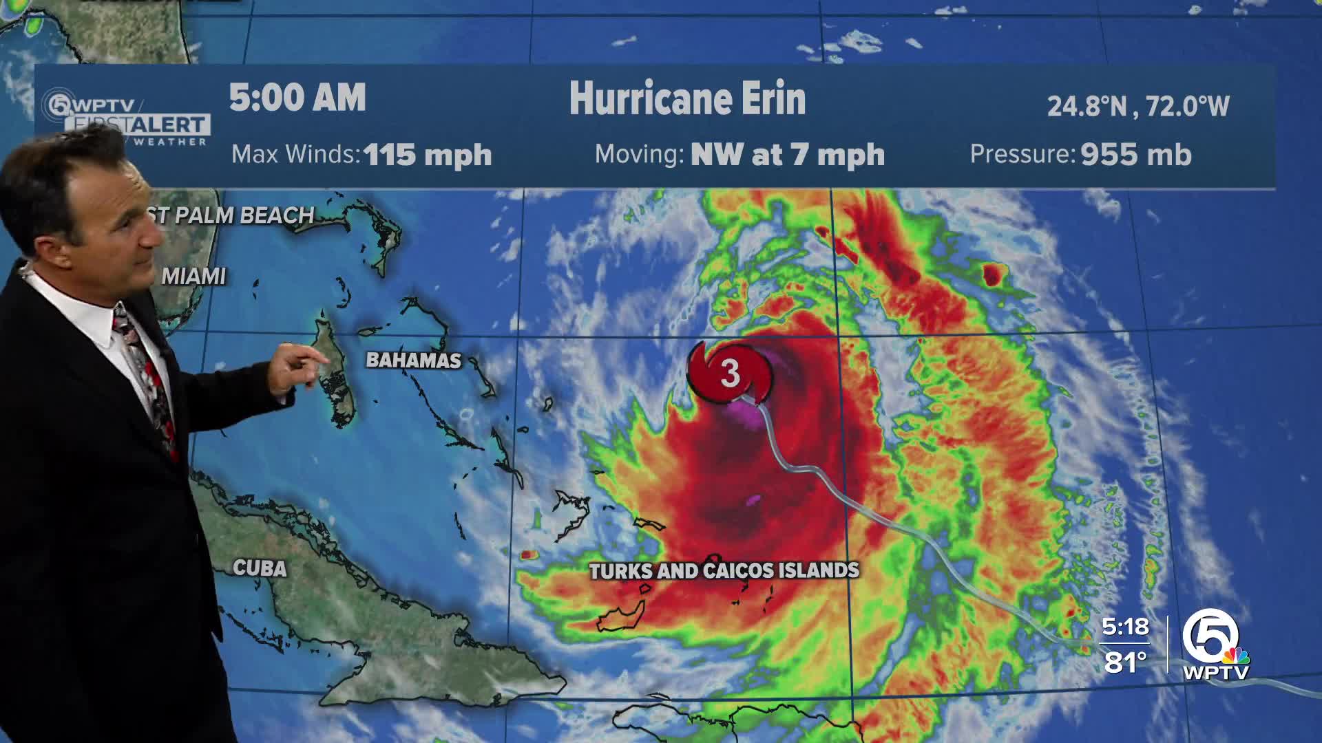


WEST PALM BEACH, Fla. — The National Hurricane Center said in its 2 p.m. Tuesday advisory, Hurricane Erin is still a Category 2 storm, packing maximum sustained winds of 105 mph while moving north-northwest near 10 mph.
The storm is almost directly west of Miami and is continuing to move north, so it will have no impact on our area besides swells moving in.
We can expect dangerous surf conditions in the water, with an extreme risk for rip currents, longshore currents, and powerful breaking waves through the end of the week and some lingering over the weekend. It is not advised to get in the water unless you are an experienced and well-traveled surfer.

Erin is forecast to weaken a bit more due to shear and dry air, but may strengthen again and sideswipe the Outer Banks area of the Carolinas as a Category 3 before curving into the northeast Atlantic. A Storm Surge Warning and Tropical Storm Warning have been issued for the Outer Banks area as locals prepare for potential flooding. A Tropical Storm Watch has been issued for areas north of Duck, North Carolina up to Cape Charles Light, Virginia.
TRACKING THE TROPICS: Hurricane Center | Hurricane Guide
Besides Erin, there are two other areas in the Atlantic that the National Hurricane Center is monitoring. One area near the Leeward Islands has a 60% chance of development within the next week. Models are showing development, but not as strongly as Erin, and may be taking a similar track. Still too early to be certain.
The other is further out in the Atlantic and currently has a 30% chance of development in the next seven days. While the environment is favorable now, it may run into an unfavorable environment down the road.
It is a good time to review hurricane plans and make sure you're prepared as we head into the peak months of hurricane season.


