
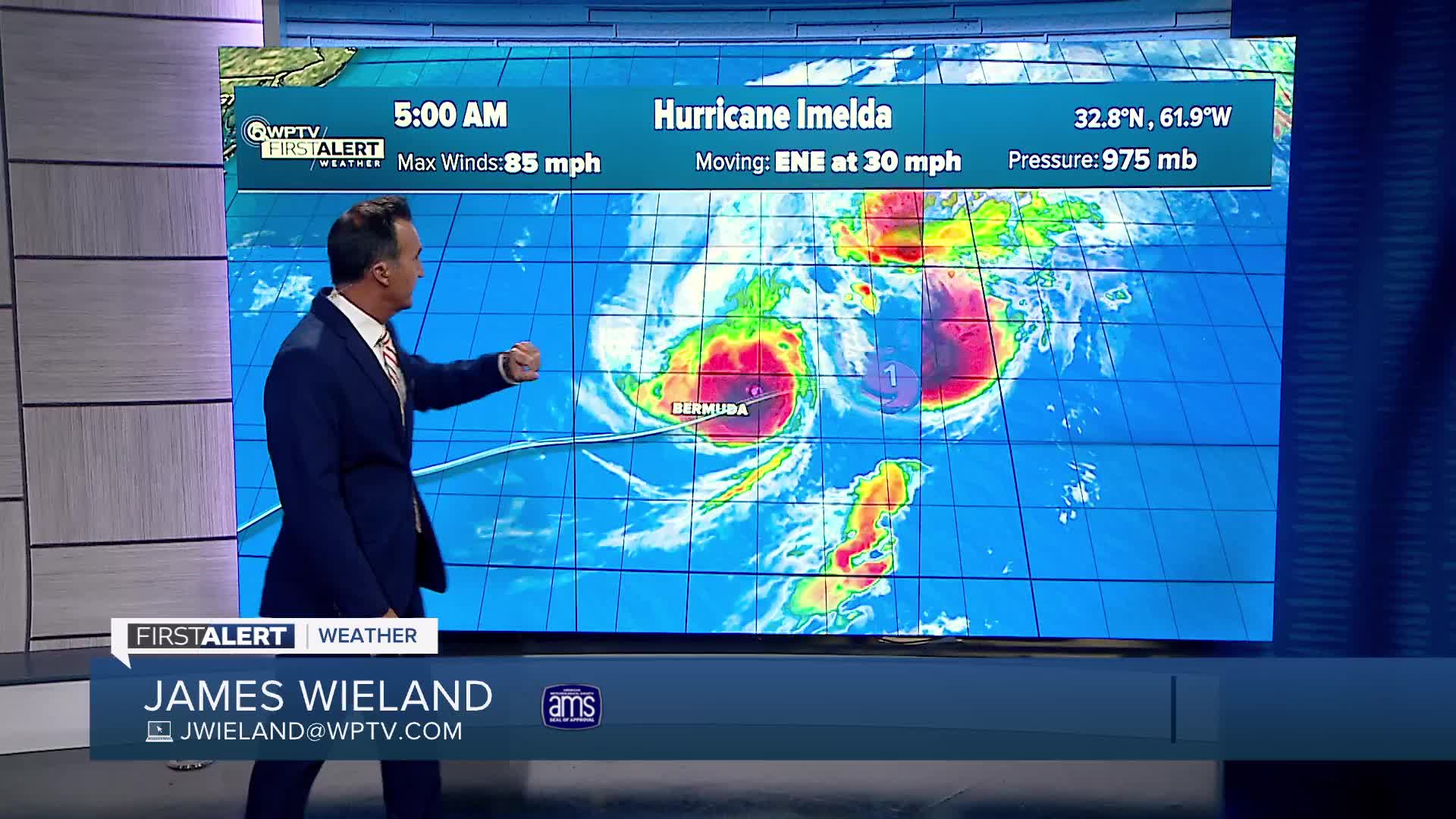


WEST PALM BEACH, Fla. — After directly hitting Bermuda overnight as a hurricane Imelda is now quickly moving away to the northeast and has lost its tropical characteristics.
Even though it’s moving far into the Atlantic, we’ll still feel Imelda's effects along the coast. Dangerous beach and marine conditions will continue into the weekend, including life-threatening rip currents, high surf with waves of 5- 9 feet, and minor to moderate beach erosion, especially around high tide. If you're heading to the beach, conditions will not be safe for swimming or small boats.
Meanwhile, in the eastern Atlantic, a tropical wave is expected to move off the coast of Africa in the next day or two. After that, it may interact with another disturbance already in the area. There’s a chance this combined system could slowly develop as it moves west to northwest at about 15-20 mph. It’s something to keep an eye on over the coming days.

Closer to home, we are also watching just east of South Florida, where a low-pressure system could form near the northwest Bahamas or southern Florida by Saturday. If it does, any development is expected to happen slowly as it moves northwest across Florida and into the eastern Gulf of Mexico. Heavy rainfall is expected to impact South Florida regardless of development.

TRACKING THE TROPICS: Hurricane Center | Hurricane Guide


