
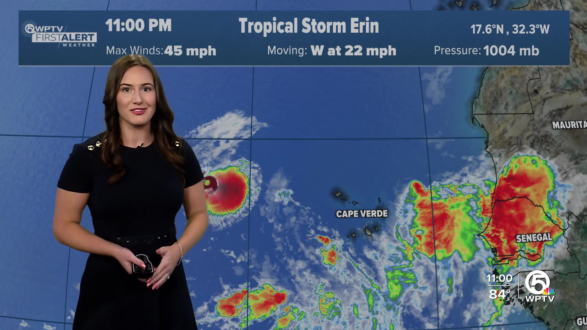


WEST PALM BEACH, Fla. — Tropical Storm Erin formed Monday in the Atlantic just west of the Cape Verde Islands. The storm now has maximum sustained winds near 45 mph.
According to an 11 p.m. advisory from the National Hurricane Center, the storm is moving west around 22 mph and is expected to continue in this direction for the next several days.
TRACKING THE TROPICS: Hurricane Center | Hurricane Guide
Most long-range forecast models show Erin gradually turning north after moving slightly north of the Leeward Islands next week. However, the exact timing and degree of that turn remain uncertain, and it is still too soon to know if the storm will pose any threat to Florida or the U.S. mainland.
In the short term, cooler waters and pockets of dry air will likely limit rapid strengthening.

By late week, warmer waters and more favorable atmospheric conditions could allow Erin to intensify more quickly, with some models projecting it could become a major hurricane.
The WPTV First Alert Weather team will continue to track Erin and bring you updates as new forecasts are issued.


