
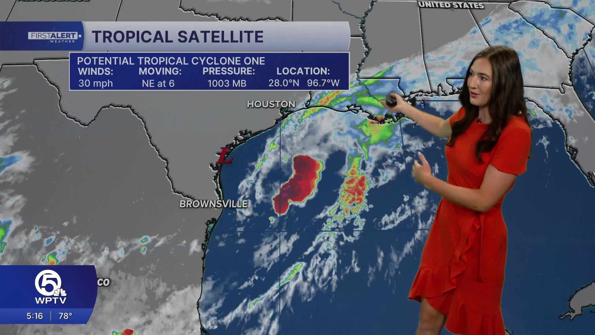


The National Hurricane Center is monitoring a broad area of low pressure in the western Gulf of Mexico that could see limited tropical development before reaching the Texas coast.
Satellite imagery shows a large area of disorganized showers and thunderstorms stretching across portions of the western Gulf. While environmental conditions remain somewhat favorable, the system has struggled to develop a well-defined center of circulation. Forecasters at the National Hurricane Center (NHC) say there is still a window for the disturbance to become a tropical storm before moving inland over Louisiana. However, time is running short as the system drifts closer to the Texas coastline.

Regardless of tropical development, impacts are expected across portions of southeastern Texas and southwestern Louisiana. Deep tropical moisture associated with the disturbance is forecast to produce periods of heavy rainfall capable of causing localized flash flooding. Areas that experience repeated rounds of thunderstorms could see the greatest rainfall totals.
Gusty winds, dangerous lightning and rough marine conditions will also be possible near the coast, especially within stronger rain bands.
The National Hurricane Center notes that the system's chances of development will decrease once it moves inland and loses access to the warm Gulf waters that help fuel tropical systems.
While the disturbance is not expected to impact South Florida directly, it serves as another reminder that the Atlantic hurricane season is underway and tropical activity can develop quickly across the Gulf of Mexico during the early summer months.
TRACKING THE TROPICS: Hurricane Center | Hurricane Guide


