



WEST PALM BEACH, Fla. — Isaias is no longer a tropical cyclone, but its impacts are far from over.
According to the National Hurricane Center's 4 a.m. CDT Saturday advisory, Isaias transitioned into a post-tropical cyclone after making landfall near Destin, Florida, Friday evening.
TRACKING THE TROPICS: Hurricane Center | Hurricane Guide
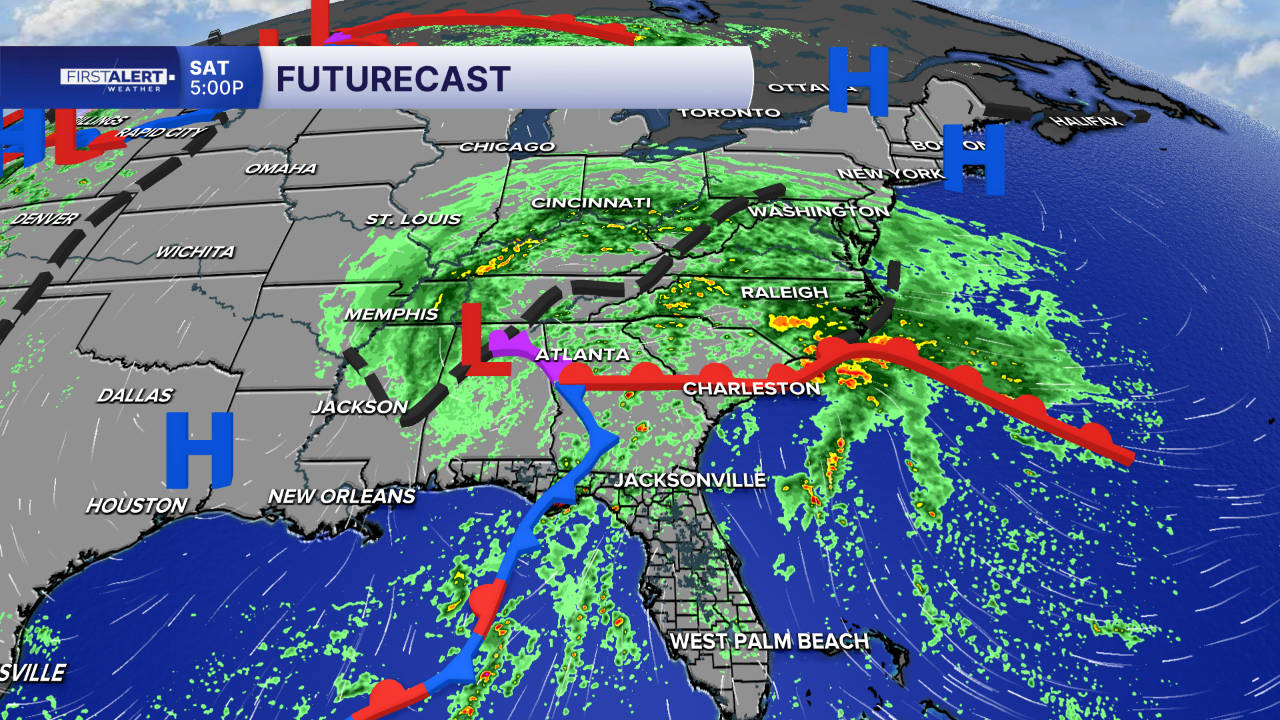
The system is now moving northward, carrying heavy tropical moisture into the Tennessee Valley, Southern Appalachians and portions of the Southeast.
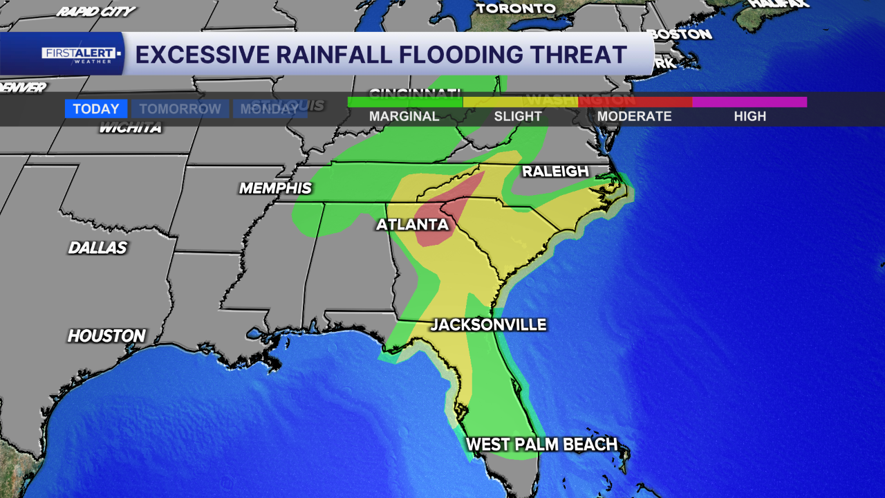
While Isaias is weakening, the National Hurricane Center warns that considerable flash flooding and urban flooding remain possible along its path.
Heavy rainfall associated with the remnants of Isaias is expected to spread quickly northward throughout Saturday.
What does post-tropical mean?
A post-tropical cyclone is a former tropical cyclone that no longer has the characteristics needed to be classified as tropical.
That doesn't necessarily mean the storm has dissipated or that its impacts have ended.
Post-tropical systems can continue producing heavy rainfall, strong winds and flooding as they move inland and interact with other weather systems.
In the case of Isaias, the primary concern has shifted from its coastal landfall to the widespread rainfall and flooding threat farther inland.
Safety remains important after the storm
For communities affected by Isaias, the National Hurricane Center urges residents to follow instructions from local officials and avoid flooded areas and downed power lines.
Generators should only be operated outdoors, at least 20 feet away from homes and garages, to reduce the risk of carbon monoxide poisoning.
Residents cleaning up storm damage should also use caution with chainsaws and power tools and stay hydrated in the heat.
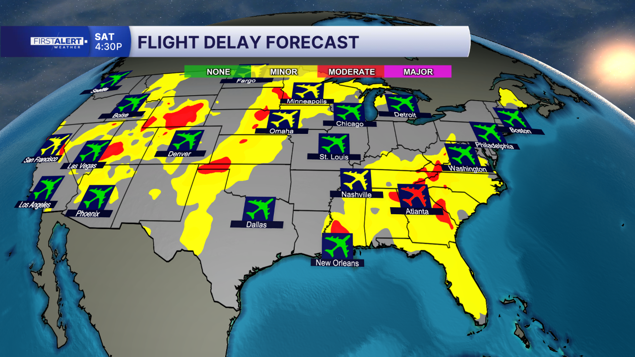
Travelers heading through portions of the Southeast this weekend should prepare for possible delays as the remnants of Isaias continue spreading heavy rainfall northward.
The excessive rainfall outlook highlights areas at risk for flash flooding, with some communities facing a greater threat where heavy rain repeatedly moves over the same locations.
Travelers should check road conditions and flight status before leaving, allow extra travel time and never attempt to drive through flooded roadways.


