WEST PALM BEACH, Fla. — Hurricane Lee is remaining a major hurricane and is forecast strengthen to a Category 4 by Monday morning.
In the 11 p.m. update from the National Hurricane Center, Lee hasd maximum sustained winds of 115 mph and was moving west-northwest at 9 mph. Lee was about 285 miles northeast of the Northern Leeward Islands.
Computer models continue to show a path to the west-northwest, then a turn to the north by the middle of this week, keeping the center of Hurricane Lee away from the U.S.
On the forecast track, Lee is expected to pass well to the north of the Northern Leeward Islands, the Virgin Islands and Puerto Rico into early next week.

While the center will stay away from the U.S., Lee will produce big swells and rough surf up and down the east coast Sunday and worsen through the week.

TRACKING THE TROPICS: Hurricane Center | Hurricane Guide
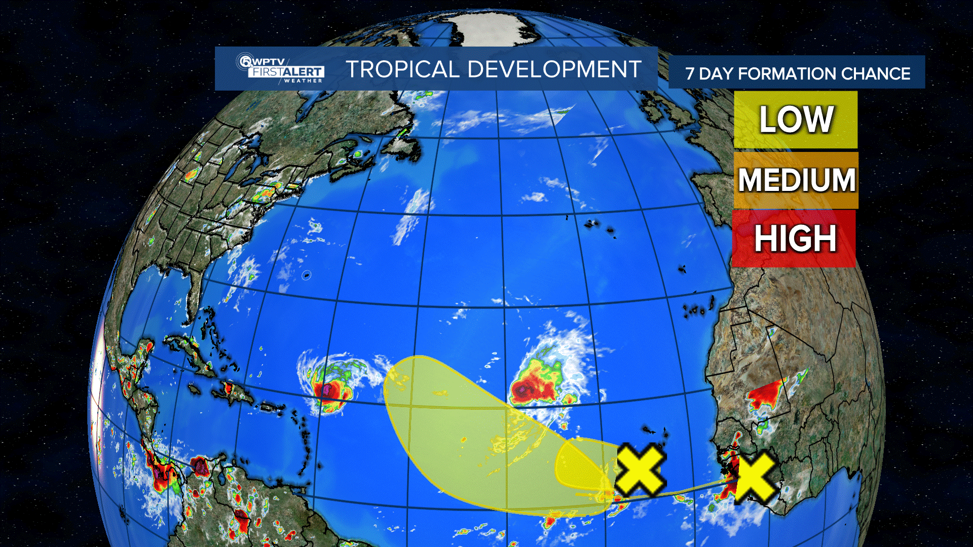
Tropical Storm Margot in the Eastern Atlantic will strengthen to a Category 1 hurricane by Tuesday.
In the 11 p.m. update, Margot had maximum sustained winds of 50 mph and was moving west-northwest at 9 mph. Margot was about 1,060 miles west-northwest of the Cabo Verde Islands.
Computer models keep this system away from the U.S.

Elsewhere, a small area of low pressure, Invest 97, is a few hundred miles to the southwest of the Cabo Verde Islands. Formation chances through seven days: 30%.
A waved near the west African coast line is forecast to emerge in the eastern Atlantic over the next day or so.
Formation chances through seven days: 30%.