



WEST PALM BEACH, Fla. — The weather pattern is changing bringing gusty northeast winds, passing showers, and increasingly dangerous conditions along the Atlantic coast.
While the widespread heavy rain threat is beginning to diminish, the biggest weather concerns are shifting toward strong winds, hazardous surf and rough seas.
Today will be a transition day as the cold front pushes south and drier air gradually moves in.High temperatures will generally reach the lower 80s across the Palm Beaches and Treasure Coast. Northeast winds will strengthen throughout the day, with gusts around 30 mph across portions of Palm Beach County. Along the Treasure Coast, particularly near the beaches, gusts could reach 35 to 40 mph.
Passing showers will remain possible, especially along the Atlantic coast. Some downpours could briefly become heavy, but the overall flooding threat is expected to decrease as the day progresses.
Dangerous surf and rip currents
The most significant weather impacts will be felt along the coastline.
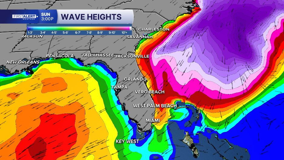
Strong northeast winds will generate large breaking waves, dangerous rip currents and the potential for beach erosion.
A High Surf Advisory is in effect for Palm Beach County, where breaking waves could reach 7 to 12 feet.
A high risk of rip currents will also make entering the ocean dangerous, even for experienced swimmers.

Hazardous boating conditions through midweek
Boaters should prepare for dangerous conditions across the Atlantic waters.
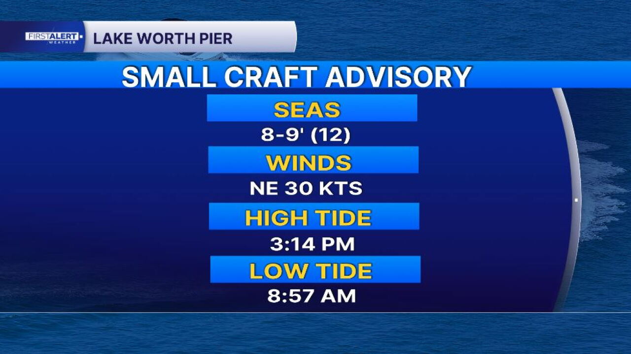
Northeast winds of 20 to 30 knots, with occasional gusts approaching gale force, will produce offshore seas building to 10 to 14 feet.
Small Craft Advisories are in effect across area waters, with hazardous marine conditions expected to continue into the middle of the week.
The strong onshore flow may also contribute to beach erosion and unusually rough conditions near inlets.
Monday: Drier weather, but the wind sticks around
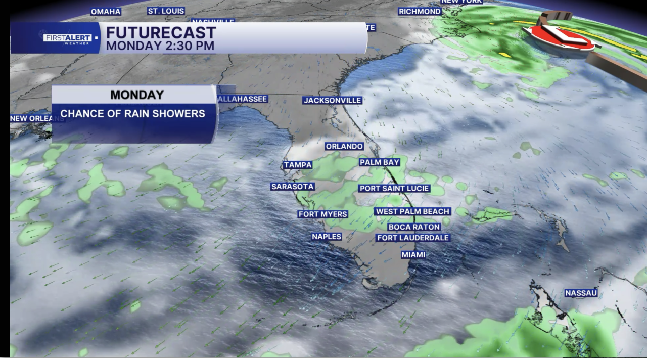
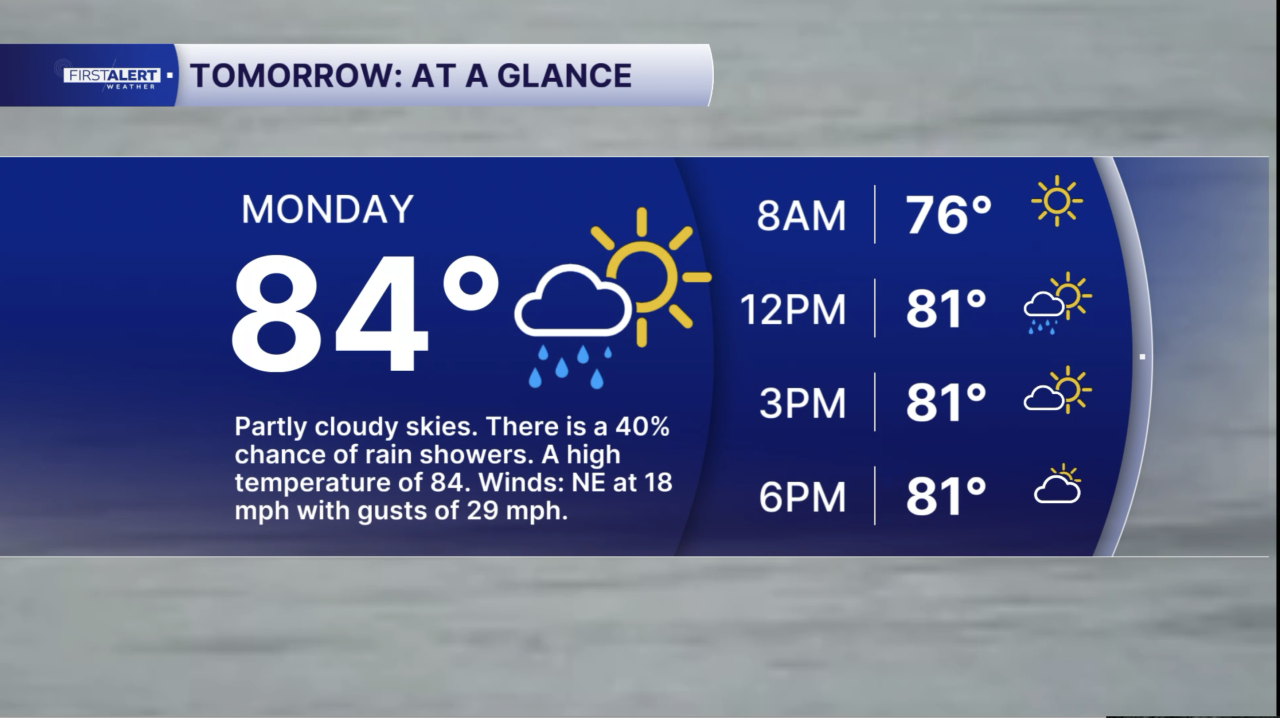
The start of the workweek will bring fewer showers as drier air settles across South Florida.
Afternoon temperatures are expected to reach 80 to 83 degrees along the Treasure Coast and 82 to 85 degrees across the Palm Beaches.
Although sunshine will become more common, gusty northeast winds will continue to affect outdoor activities, especially near the coastline.
Dangerous surf and rough boating conditions will remain concerns Monday.
MORE WEATHER: Radar | Alerts | 7-Day Forecast | Hourly Forecast
Par for the Culture celebrity golf tournament tomorrow

Tomorrow's forecast will also be important for golfers and spectators attending the Par for the Culture Celebrity Golf Tournament at Palm Beach National Golf & Country Club in Greenacres.
The event benefits The Lord's Place, a Palm Beach County nonprofit helping individuals and families experiencing homelessness regain stability and independence.
I will help host the tournament alongside Miami Dolphins quarterback Malik Willis. Golfers can expect warm temperatures in the lower to middle 80s, breezy northeast winds and a small chance of a passing shower.


