
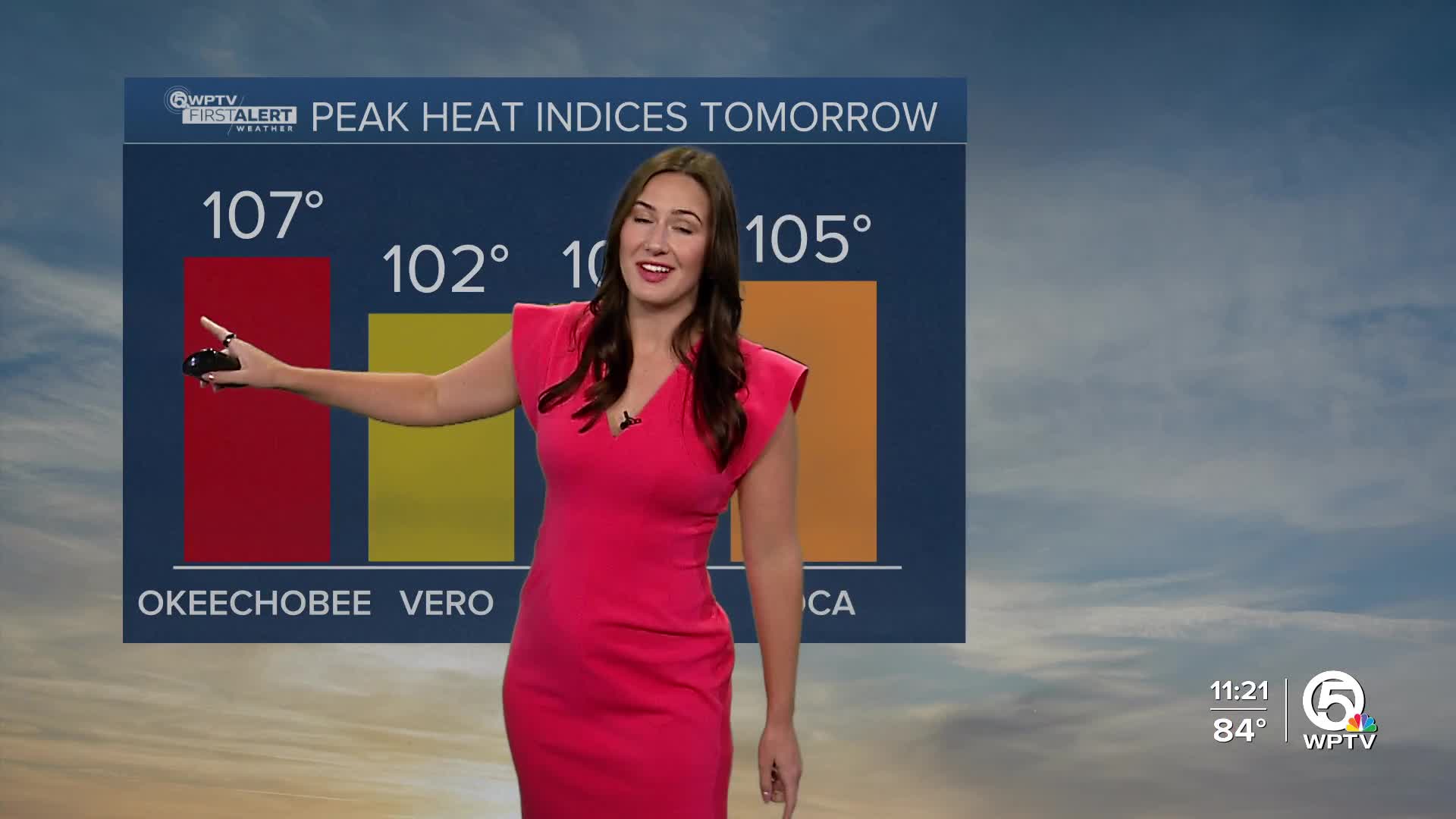


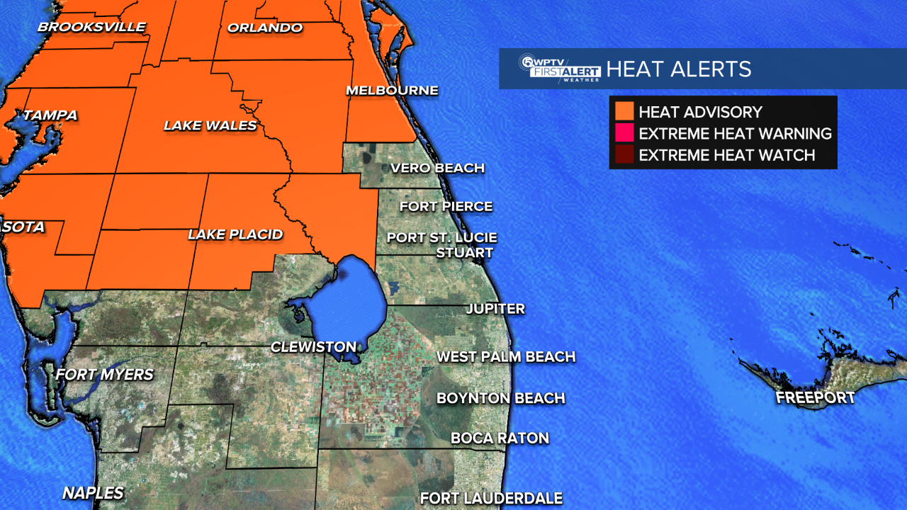
WEST PALM BEACH, Fla. — Okeechobee County is once again under a heat advisory from 12-7 PM Monday.
MORE WEATHER: Radar | Alerts | 7-Day Forecast | Hourly Forecast
There is a chance that it could be expanded into the Treasure Coast or Palm Beaches. Regardless, hot temperatures and high humidity could cause heat illnesses. Outdoor workers should take extra precautions including frequent breaks in the shade along with staying hydrated.
Lighter concentrations of Saharan dust will linger into Monday. The hot, humid, and mainly dry trend will continue through the middle half of the week. Highs will reach for the low-mid 90s with heat indices near 105.
Monday will be a partly sunny day. An isolated downpour or brief thunderstorm could fire up along the sea breeze during the later afternoon.
A few more storms are possible Tuesday, but it is mainly a dry day with sunshine. Wednesday is a similar day to Tuesday with a few storms possible in the afternoon along the sea breeze. Highs in the lower 90s persist with heat index values near 105 each day.
It starts to become more active on our radar for the later end of the week and into the weekend as a low pressure system starts to dig into the southeast. Expect spotty to scattered showers/t-storms Friday through next weekend.
We are continuing to monitor tropical waves coming off of Africa. However, at this time, nothing is expected to develop in the Atlantic during the next 7 days.


