


WEST PALM BEACH, Fla. — We'll stay dry tonight and Saturday with lows dropping into the mid-upper 50s tonight and mid to upper 70s for highs on Saturday and Sunday.
On Sunday, a robust low-pressure system and trough pushes across the Gulf of Mexico and into the Florida Peninsula.
MORE WEATHER: Radar | Alerts | 7-Day Forecast | Hourly Forecast
A warm front will lift north across the region Sunday and then a line of showers and storms will move in — generally between 11 a.m. to 2 p.m.
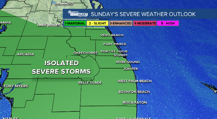
The Storm Prediction Center has placed our area under a threat of severe weather with the main hazards being gusty winds, heavy rainfall and even a brief tornado will be possible.
Rain amounts look to generally stay around half an inch with a few localized spots seeing slightly higher amounts.
On Monday, the low sweeps into the western Atlantic.
There are lower rain chances on Monday but still a chance of showers.
A tight pressure gradient will keep winds elevated through mid-week.


