
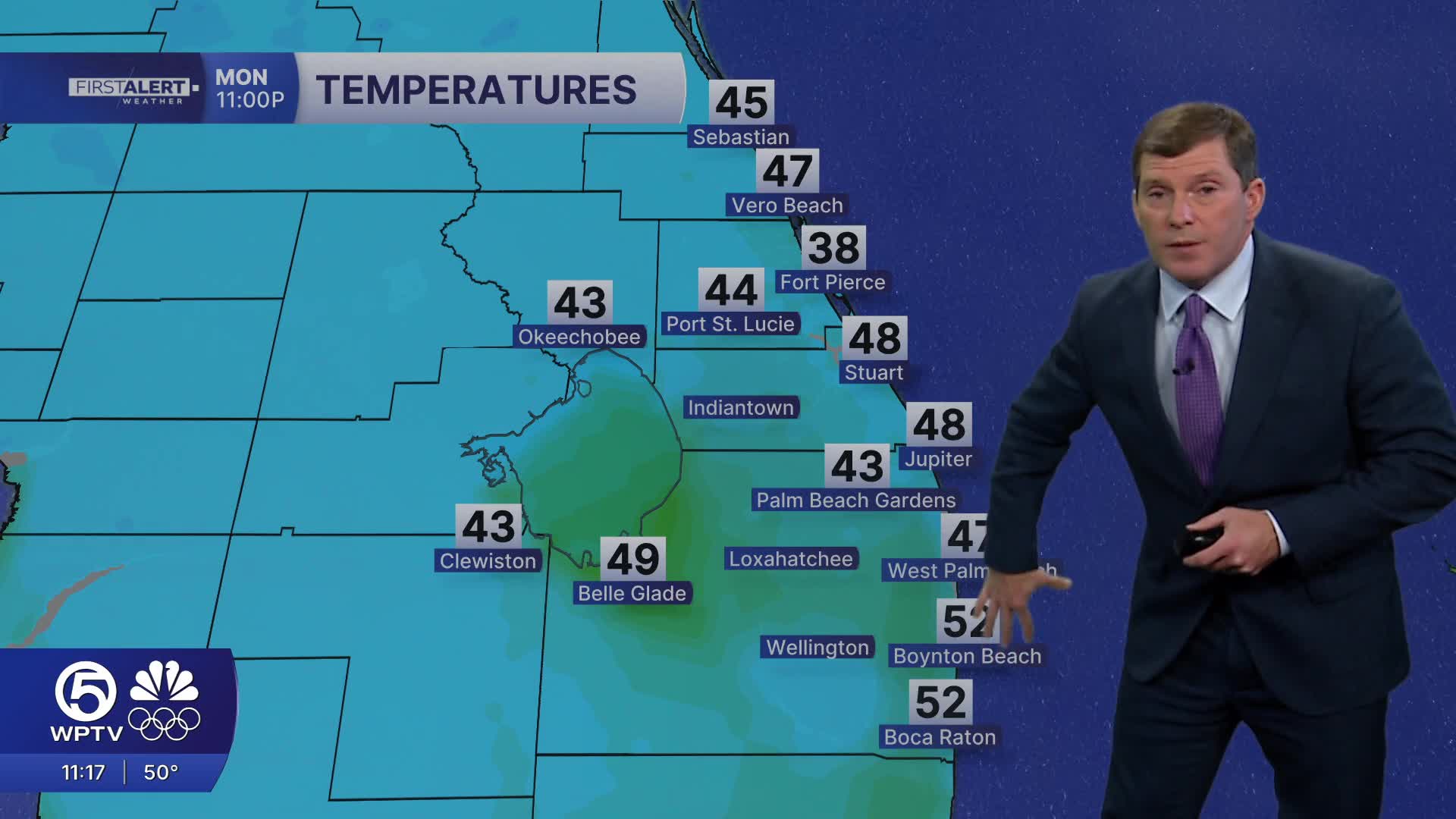


WEST PALM BEACH, Fla. — A blast of colder, much drier air has settled in behind a cold front, sending temperatures tumbling into the 30s and 40s, with wind chills dipping into the 20s in some spots.
Afternoon highs will struggle to reach the mid-to-upper 50s, or low 60s, nearly 15 degrees below normal.
MORE WEATHER: Radar | Alerts | 7-Day Forecast | Hourly Forecast
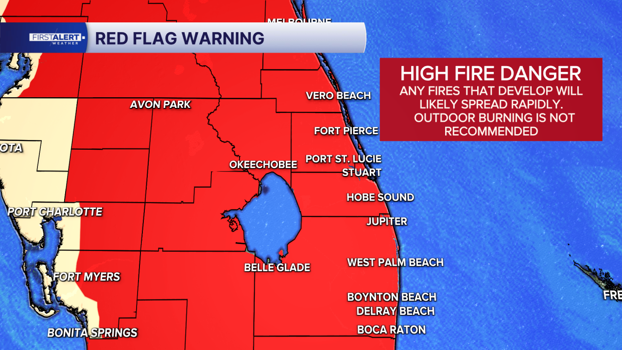
Breezy northwest winds, 15–25 mph with higher gusts, combined with very low humidity and ongoing drought conditions, have created high fire danger across the region, a concern that will linger through midweek.
On top of that, a Freeze Warning is in effect for much of the interior, with temperatures expected to drop to or below freezing overnight tonight. Residents should bundle up, bring pets indoors, and protect sensitive plants, and use space heaters safely.
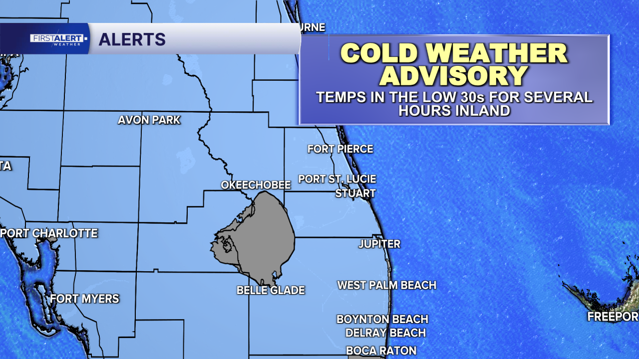
The coldest stretch arrives Monday night into early Tuesday, when many inland communities could see lows in the upper 20s to low 30s. Even areas that stay just above freezing will likely experience frost, especially Tuesday night as skies clear and winds lighten. Another Cold Weather Advisory is in place early Tuesday morning, with wind chills again dipping into the 20s to low 30s.
The good news? A quick warm-up begins midweek. By Wednesday, highs rebound into the 70s, and by Thursday and Friday, much of the area will climb into the low 80s — above normal for late February. Rain chances also return late week into the weekend, with scattered showers (and perhaps a few isolated storms) bringing some much-needed rainfall.
If you're heading to the beach or out on the water, conditions will be rough. Boaters will face hazardous conditions through today and tonight, with strong northwest winds and seas building as high as 7 to 12 feet offshore.
Small craft advisories remain in effect, and conditions will only slowly improve into Tuesday. Beachgoers should also be aware of a High Risk for rip currents today as the swell picks up, making swimming dangerous. As winds shift and weaken later in the week, boating conditions will improve, but for now, it’s best to use extreme caution — whether you're lighting a grill, planting flowers, or planning a day on the water.
**Portions of this story were assisted by artificial intelligence tools and reviewed by a WPTV journalist to ensure accuracy, clarity, and adherence to editorial standards.


