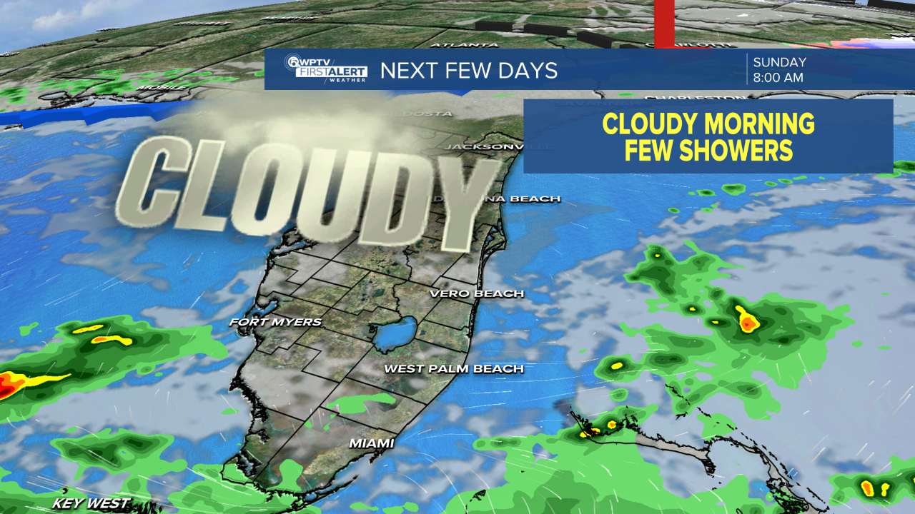


WEST PALM BEACH, Fla. — Showers and a few thunderstorms are expected to develop late tonight, spreading from south to north.
Some storms could briefly produce gusty winds, lightning, and localized heavy rainfall.
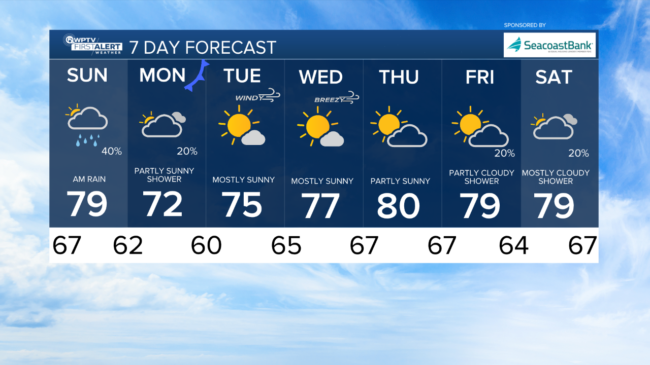
Rain chances taper off by Sunday afternoon as a cold front moves through the region. Behind the front, noticeably cooler and drier air will move in, along with strengthening north to northeast winds.
MORE WEATHER: Radar | Alerts | 7-Day Forecast | Hourly Forecast
Sunday night into Monday will be breezy to windy, with gusts potentially topping 25 to 30 mph, especially along the coast.
Beach goers should exercise caution today, as a high risk of rip currents remains in effect for all beaches through tonight.
Dangerous surf conditions are also likely to redevelop early next week as strong onshore winds increase behind the front.

Early next week will feel cooler and more comfortable, with highs in the mid to upper 70s and morning lows dipping into the 50s inland, and low to mid 60s closer to the coast.
The coolest mornings are expected Tuesday, followed by a gradual warming trend by midweek under dry, sunny skies.