


WEST PALM BEACH, Fla. — It’s shaping up to be a warm and mostly dry weekend across South Florida and the Treasure Coast, but changes are on the way as we head into early next week.
Early Saturday morning, some inland areas may wake up to patchy fog, especially across rural spots. Visibility could briefly drop in places, so if you’re heading out early, take it slow and use low beams. The fog will clear quickly after sunrise.
Inland communities could reach the upper 80s to low 90s, with some spots nearing record highs for mid-April. Today's record in West Palm is 93 degrees set in 2015. Coastal areas will stay a bit cooler, in the low to mid 80s, thanks to the sea breeze. It will stay warm and slightly more humid overnight, with lows in the upper 60s and low 70s.
Sunday looks similar, warm, a bit more humid, and still mostly dry. A few isolated showers are possible, but most areas stay rain-free through the day.
MORE WEATHER: Radar | Alerts | 7-Day Forecast | Hourly Forecast
A cold front will begin moving into Florida late Sunday into Monday, bringing a noticeable shift in the weather.
Rain chances increase overnight Sunday and into Monday, with scattered showers and even a possible isolated thunderstorm. Rainfall totals generally look light to moderate, but some areas could pick up around an inch.
Behind the front, cooler air moves in. High temperatures early next week drop back into the upper 70s and low 80s much closer to normal for this time of year.
The biggest change will be the wind.
Gusty northeast winds develop Monday and Tuesday, with sustained speeds around 15 to 25 mph and gusts over 30 mph at times, especially near the coast.
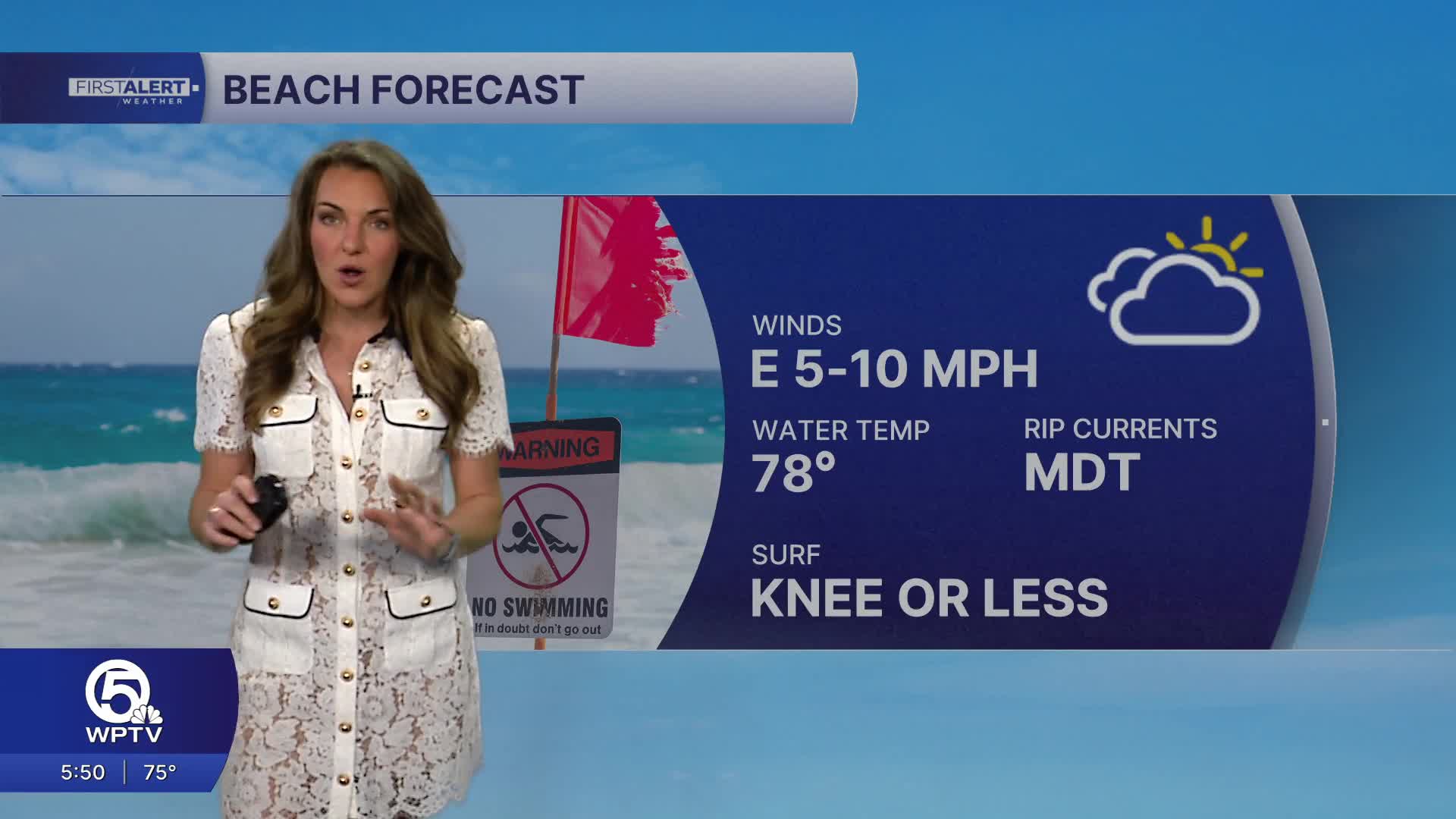
This will lead to deteriorating beach and boating conditions.
Rain chances taper off by Tuesday as drier air moves in. The rest of the week trends mostly dry with a gradual warming pattern returning by Thursday and Friday.
There is still some uncertainty late in the week, as another disturbance could develop nearby, but for now, the forecast favors limited rain and more sunshine.


