


MIAMI — The National Hurricane Center is looking at tweaking the forecast cone graphic they use when predicting an area where a tropical system will impact.
The agency made the announcement this month, calling it an "experimental version" that will add a depiction of tropical storm and hurricane watches and warnings over inland areas in the U.S.
However, this new rendering won't start at the beginning of hurricane season on June 1, instead "on or around" Aug. 15 ahead of the peak season for storms.
The new product will be in addition to the standard cone that the NHC has used in previous years.
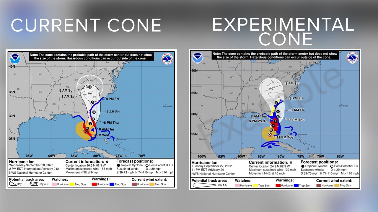
The cone graphic currently only shows watches and warnings in a line along the coastline of the affected area.
"The watch and warning depiction will be predominant on the graphic," the NHC said in a statement. "Watches and warnings in effect for land areas will take precedence over the cone."
Forecasters believe this change will help the public understand the risk of strong winds during tropical systems. Several studies have suggested that the addition of inland watches and warnings will help alleviate misinterpretation of the cone related to strong winds, according to the NHC.
The National Hurricane Center will begin issuing an experimental Tropical Cyclone Forecast Cone Graphic on our around August 15, 2024, that includes inland tropical storm and hurricane watches and warnings for the continental U.S.
— National Hurricane Center (@NWSNHC) February 6, 2024
Read more here: https://t.co/zHGVE26Avz pic.twitter.com/RhX8vSE5OA
The new experimental graphic will be available on the NHC website for both full and intermediate advisories.
The National Hurricane Center said they will take comments from users and evaluate that feedback when making future decisions about cone models.
The "cone of uncertainty," as it is often dubbed, is a main topic of debate as weather experts seek to refine tropical forecasts that offer concise information while predicting the storm's path.
The Atlantic hurricane season runs from June 1 through Nov. 30.


