


WEST PALM BEACH, Fla. — The last week of spring will definitely feel summery with afternoon storms and highs building into the lower-mid 90s.
MORE WEATHER: Radar | Alerts | 7-Day Forecast |
Sunday may actually feature the highest overall storm coverage of the weekend as moisture peaks across the region.
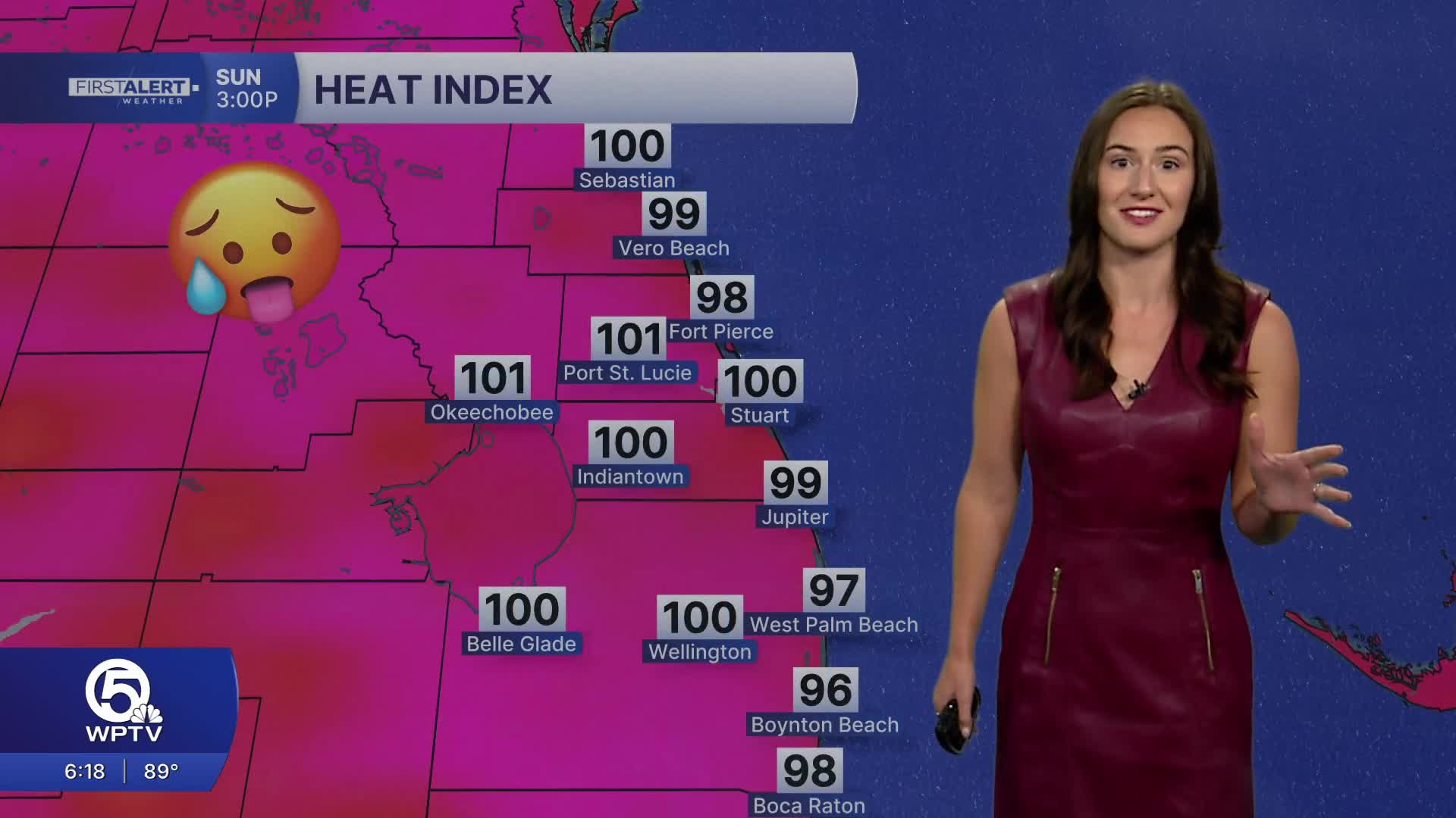
The morning looks the most promising for outdoor activities with partly sunny skies and the coolest temperatures of the day. It will get hot and humid in the afternoon with highs approaching 90 and feels-like temperatures topping 100.
Spotty to scattered storms once again develop during the afternoon and evening hours. We will be watching for heavy downpours in thunderstorms that could result in minor flooding, especially in poor draining areas near the coast.
The next few days remain unsettled with scattered to numerous showers and thunderstorms developing across the area in the afternoon and evenings.
Later in the week, it looks a bit drier which will allow for temperatures to climb. Highs will build into the lower-mid 90s with heat indices reaching 105 through the end of the work week. Heat Advisory criteria may be warranted for inland areas. Stay cool and hydrated!

