


WEATHER SUMMARY
Weak low pressure has developed along a stalled out frontal boundary that pushed through south Florida during the day Monday.
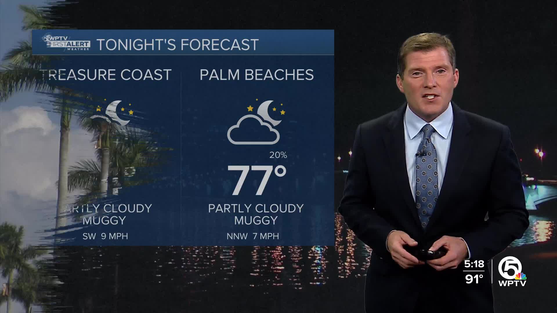
MORE WEATHER: Radar | Alerts | 7-Day Forecast | Hourly Forecast
Unlike the fall and winter months though, we're not expecting much of a change behind this front. As a result, it will remain hot and incredibly humid through the end of the week with temperatures in the low 90s and heat indices in the low 100s every day.
Given the close proximity and slow movement of this broad area of low pressure, scattered showers and thunderstorms will be possible every day during the mid to late afternoon hours.
We'll have to keep an eye out for isolated areas of urban flooding. One or two of these storms could be on the stronger side as well with winds 40-50 mph.
BEACH CONDITIONS
Wave heights will build slightly over the next few days (2 to 4 feet). This in turn will create a stronger undertow for some of the local beaches in south Florida. As of now there is a low risk of rip currents. But this may change by the middle of the week. Please only swim on guarded beaches.
BOATING CONDITIONS
The waters could be a little choppy at times on the Treasure Coast Tuesday (3 to 5 feet), smoother off the coast of Palm Beach county and areas south (1 to 2 feet). Light northerly winds.
7 DAY FORECAST
TUESDAY: Very hot and humid with a spotty shower or thunderstorm during the afternoon. High 93. Heat Index 102
WEDNESDAY: Hot and humid. Scattered downpours and thunderstorms during the afternoon. High 92.
THURSDAY: Hot and humid. Scattered downpours and thunderstorms during the afternoon. High 92.
FRIDAY: Hot and humid. Scattered downpours and thunderstorms during the afternoon. High 93. Heat Index 105
SATURDAY: Mostly sunny, hot and humid. A few showers and thunderstorms are likely during the afternoon. High 92.
SUNDAY: Mostly sunny, hot and humid. A spotty afternoon thunderstorm is possible. High 92.
MONDAY: Sun and clouds. An afternoon shower or thunderstorm is possible for some. High 91.
THE TROPICS
A tropical wave has come off the African coast. This disorganized area of showers and thunderstorms is expected to develop slowly over the next few days possibly becoming a depression by the end of the week. It is possible that this feature eventually becomes Gabrielle down the road. But thankfully, the computer data currently curves the storm out to sea and away from the U.S. mainland by the beginning of next week. Otherwise, the Atlantic basin is very quiet as we quickly approach the peak of hurricane season.


