


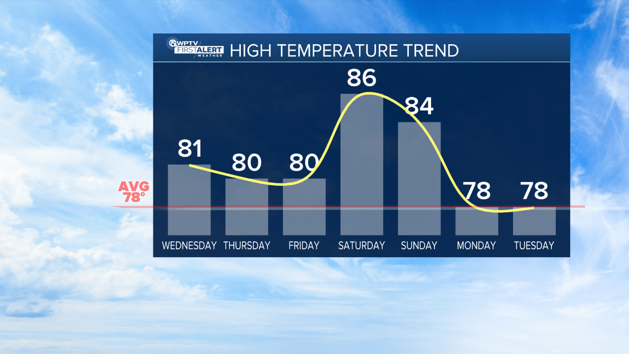
WEST PALM BEACH, Fla. — As the cold front passes through early Wednesday morning, it won't be as strong as the last, so don't expect a dramatic drop in temperatures. It will, however, dry things out for the rest of the week with lower humidity.
WPTV First Alert Weather Forecast for Night of Dec. 2, 2025
MORE WEATHER: Radar | Alerts | 7-Day Forecast | Hourly Forecast
Expect sunny conditions Wednesday through Friday with highs in the upper 70s or near 80.
Heating up again into the mid-80s this coming weekend, with showers returning.
WPTV
WPTV


