
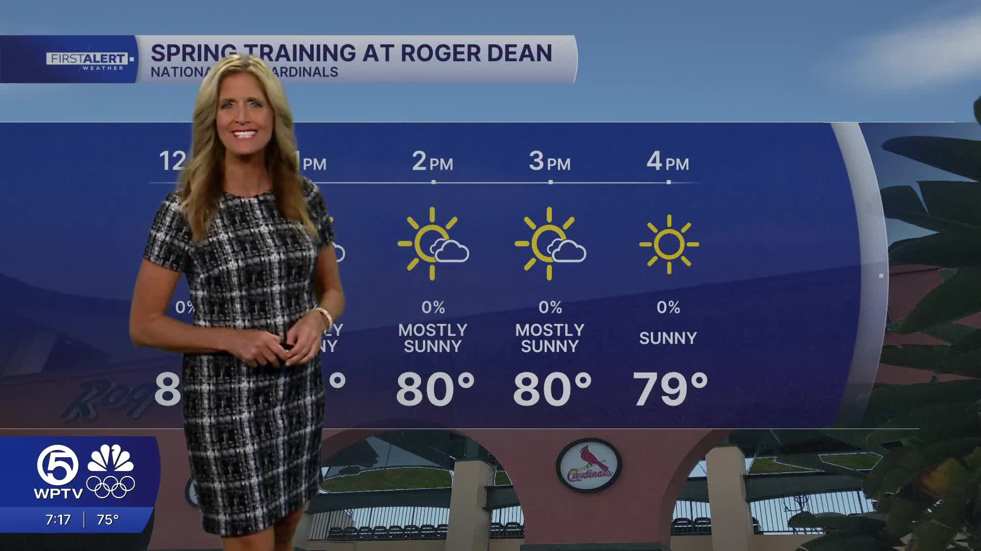


WEST PALM BEACH, Fla. — If you like toasty temps - you will love the weather this weekend. Look for near-record highs with temps in the mid to upper 80s.
High pressure remains in control through Saturday, keeping skies mostly sunny with mainly dry conditions. Overnight lows will stay mild, generally in the 60s.
MORE WEATHER: Radar | Alerts | 7-Day Forecast | Hourly Forecast
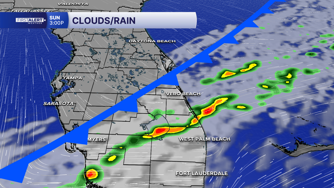
Big changes come late in the weekend. A cold front is expected to move through South Florida Sunday afternoon into Sunday evening. There will be enough moisture in place for scattered showers, though thunderstorm chances remain very limited.
Behind the front, a much cooler and drier air mass settles in early next week. Gusty northwest winds Sunday night into Monday will usher in strong cold air. High temperatures on Monday and Tuesday will struggle to reach 70 degrees, with many areas staying in the mid to upper 60s.
Tuesday morning will be our coldest, inland communities could fall into the mid 30s, while coastal communities stay near the lower 40s. Wind chills may fall into the upper 20s and 30s west of Lake Okeechobee, making for a noticeable taste of winter across the region.
Marine conditions remain relatively calm through Saturday, but will likely deteriorate late Sunday into early next week as winds and seas build behind the front.
At the beaches, a lingering northeasterly swell is keeping a high risk of rip currents in place along the Atlantic coast.
Temperatures will gradually moderate again starting on Wednesday. We'll be back to seasonal averages by Thursday with high temps in the upper 70s and lows in the 60s.


