


WEST PALM BEACH, Fla. — We will dial the wind and rain chances back a bit on Wednesday. Highs will be in the upper 80s with more sun around and less rain.
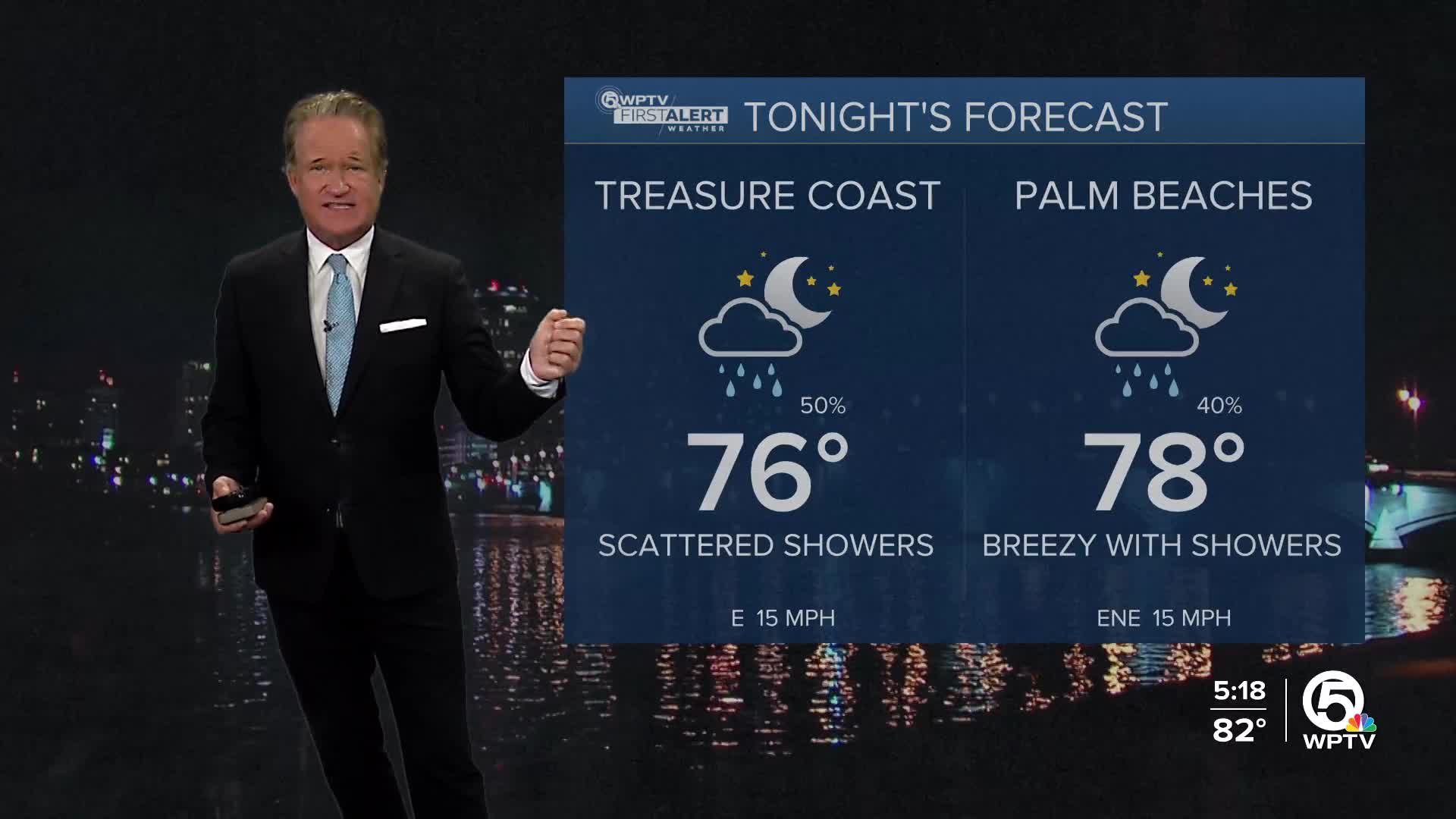
WPTV First Alert Weather Forecast for Evening of Tuesday, Oct. 7, 2025
MORE WEATHER: Radar | Alerts | 7-Day Forecast | Hourly Forecast
On Thursday and Friday, rain chances increase as a developing low near the Bahamas could bring heavier rainfall to the coast. Winds will stay gusty, and coastal flooding threats may worsen—potentially prompting flood advisories.
By Saturday, a cold front, our first of the season, will push through and bring our first taste of autumn with temperatures dropping into the low 80s and humidity dropping to more comfortable levels Sunday and Monday. Rain chances also drop for a few days.


