


WEST PALM BEACH, Fla. — Monday will feel much like recent days, with mild temperatures and quiet weather as a strong cold front approaches from the north.
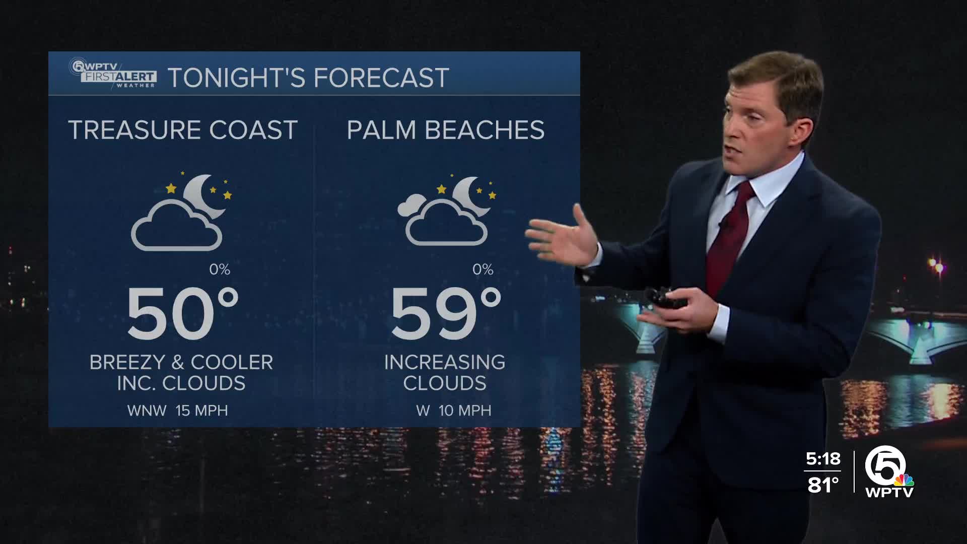
Overnight tonight, temperatures will begin to dip, particularly across northern areas. Lows near Lake Okeechobee could fall into the low 50s, while locations farther south stay closer to 60.
MORE WEATHER: Radar | Alerts | 7-Day Forecast | Hourly Forecast
The cold front moves through on Tuesday, bringing a noticeable change. Winds will shift to the north and become breezy at times, ushering in a much cooler and drier air mass. Afternoon temperatures will be 5-10 degrees cooler than last week, with highs in the low 70s along the coast and in the mid-60s near Lake Okeechobee. Any rain chances should remain offshore over the Atlantic.
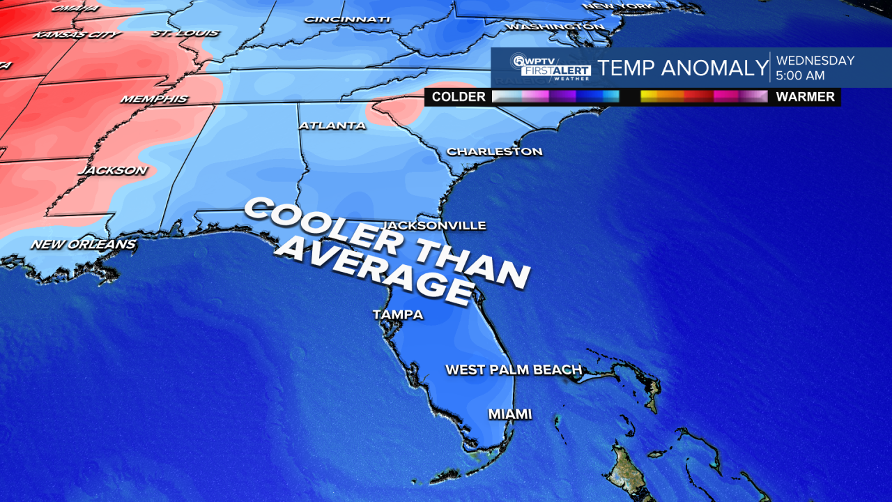
The coldest weather arrives Tuesday night and Wednesday night, marking the start of a notable cold spell. Overnight lows could dip into the mid-30s near Lake Okeechobee, with upper 30s to 40s elsewhere. Gusty winds Tuesday night may make it feel even colder, with wind chills dropping into the upper 20s to low 30s across parts of the interior. Cold Weather Advisories and possible frost advisories may be needed as the week continues.
By Thursday, winds relax, then a slow warming trend begins on Friday. Temperatures are expected to gradually return to more seasonable levels by the weekend, bringing a calmer and more comfortable end to the week.

**Portions of this story were assisted by artificial intelligence tools and reviewed by a WPTV journalist to ensure accuracy, clarity, and adherence to editorial standards.


