


WEST PALM BEACH, Fla. — A weakening cold front is passing through the area. However despite the stickiness in the air, there is no moisture attached to the front. This means no rain is expected. As high pressure begins to builds to our north, lower humidity moves in tonight behind the front.
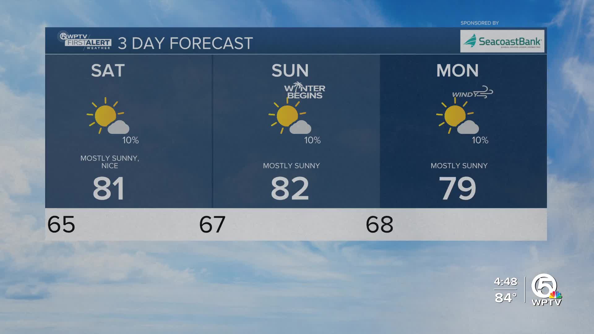
Temperatures will fall near 60 on the Treasure Coast and into the mid 60s for the Palm Beaches. Okeechobee County will wake up to the 50s on Saturday morning.
The weekend remains mainly dry and nice all together. A brief coastal shower cannot be ruled out, but widespread rain is not expected. Highs on Saturday will be in the lower 80s. Highs on Sunday are expected to be in the lower 80s, with warmer spots inland.

MORE WEATHER: Radar | Alerts | 7-Day Forecast | Hourly Forecast
A backdoor cold front, which is a front that comes in from the Atlantic, and strong high pressure will bring breezy to gusty east-northeast winds Monday and Tuesday. Isolated to spotty showers may develop, mainly along the east coast.
The winds will also create hazardous beach and boating conditions near the coast.
Highs will range from the upper 70s.
By Christmas Eve, high pressure will settle in, winds will weaken, and temperatures will remain near seasonal levels— in the mid-to-upper 70s.


