

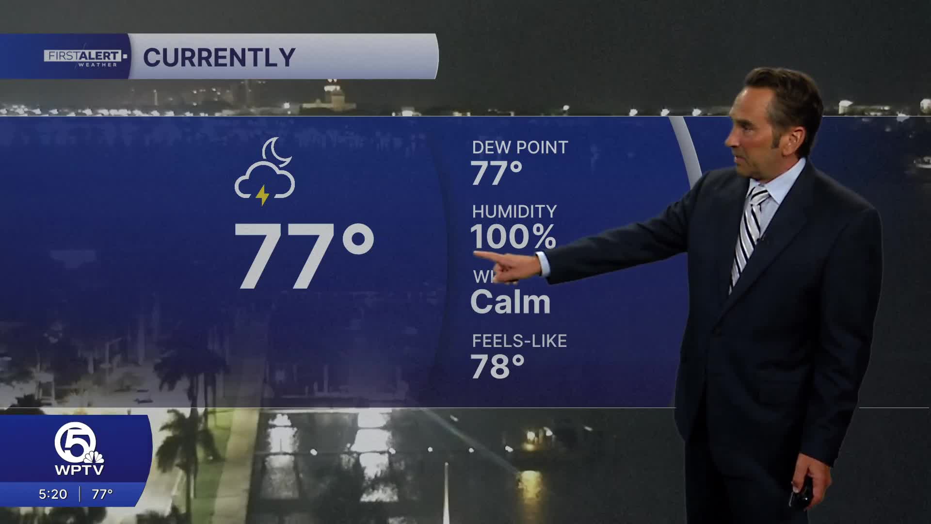


WEST PALM BEACH, Fla. — Today starts off with humid conditions and scattered morning showers across the Palm Beaches and Treasure Coast before transitioning to more widespread afternoon thunderstorms. These storms could produce locally heavy downpours, particularly where systems repeatedly track over the same areas, while temperatures reach the upper 80s with heat somewhat moderated by clouds and rain activity. Light northeast to east winds will prevail, with storm chances increasing significantly as the day progresses.

Beach safety takes center stage today, as elevated rip current risks persist along Palm Beach County shores due to lingering swell conditions. The Treasure Coast also faces elevated to high rip current dangers, making it essential for swimmers to check current beach flag warnings before entering the water. Anyone caught in a rip current should remain calm, swim parallel to shore until escaping the current, then head toward the beach rather than fighting directly against the flow.
The weekend maintains this unsettled weather pattern with very humid conditions Saturday and Sunday. Both days will likely start with some sunshine before afternoon thunderstorms develop, capable of dumping heavy rainfall in short periods and creating localized flooding risks in poor-drainage and urban areas. While winds remain relatively light between storm systems, thunderstorms can produce sudden, strong gusts that create rapidly changing conditions.
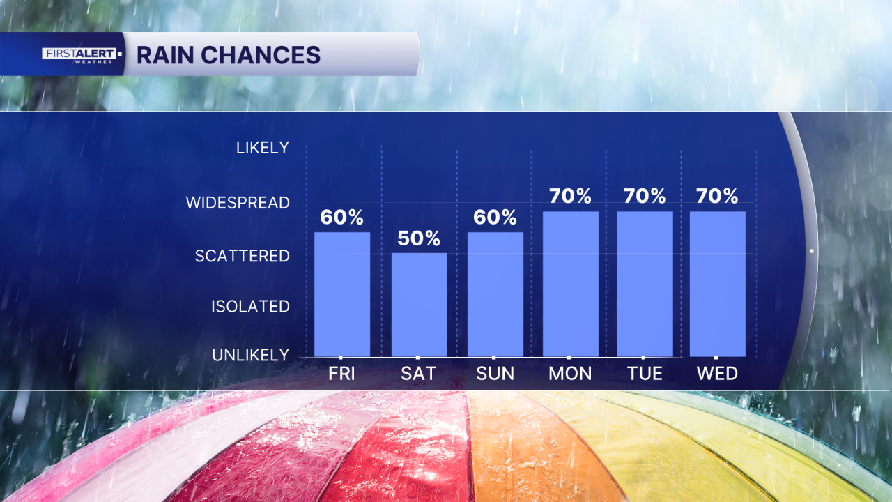
Weekend beach and boating conditions offer mixed prospects for outdoor enthusiasts. The encouraging news is that rip current risks should improve compared to Friday's elevated dangers, though this doesn't eliminate swimming hazards entirely. Beach warning flags, lifeguard proximity, and thunderstorm awareness remain critical safety factors. Boaters will find generally manageable winds and seas around 2 feet through the weekend, but thunderstorms represent the primary wildcard, capable of quickly generating strong, erratic wind gusts, lightning, and locally rough seas even when preceding conditions appear calm.
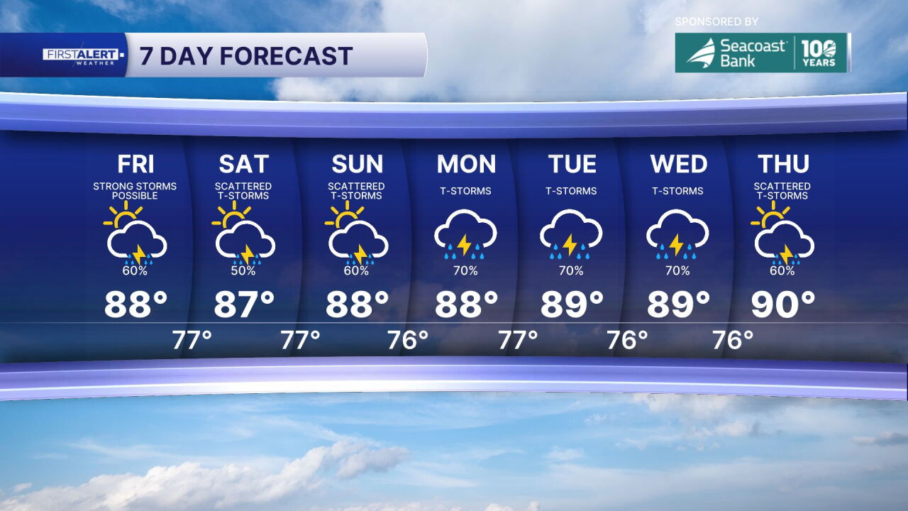
Overall, this active weather pattern demands flexible planning and heightened safety awareness, particularly around water activities where conditions can deteriorate rapidly despite initially favorable appearances.
MORE WEATHER: Radar | Alerts | 7-Day Forecast | Hourly Forecast
*Portions of this story were assisted by artificial intelligence tools and reviewed by a WPTV journalist to ensure accuracy, clarity, and adherence to editorial standards.


