


WEST PALM BEACH, Fla. — Another round of heavy thunderstorms developed Tuesday afternoon as the rainy season carries on here in South Florida.
This time of year, the atmosphere is almost always loaded with a tremendous amount of tropical moisture, so high humidity and afternoon thunderstorms should come as no surprise.
But the lack of steering currents aloft is allowing these downpours and thunderstorms to move very slowly and in some cases not at all.
As a result, we've had to deal with areas of flooding too. We'll likely see a couple more days like this before things finally begin to settle down this weekend.
<b>7-Day Forecast</b>
Tonight: Heavy evening thunderstorms ending. A spotty leftover shower or thunderstorm is possible overnight. Mostly cloudy and muggy otherwise. Low 77.
Wednesday: Hot and humid! Afternoon downpours and thunderstorms are likely. Perhaps not as widespread as the past couple of days. High 90. Heat Index: 101.
Thursday: Hot and humid. Another round of thunderstorms will likely develop. A little more spotty in nature though. High 91.
Friday: Mostly sunny, hot and humid. A spotty thunderstorm is possible. High 91.
Saturday: Mostly sunny, hot and humid. A spotty thunderstorm is possible. High 90.
Sunday: Mostly sunny, hot and humid. A spotty thunderstorm is possible. High 89.
Monday: Mostly sunny with an afternoon thunderstorm. High 90.
Tuesday: It stays hot and humid with a spotty thunderstorm around. High 90
Beach Forecast
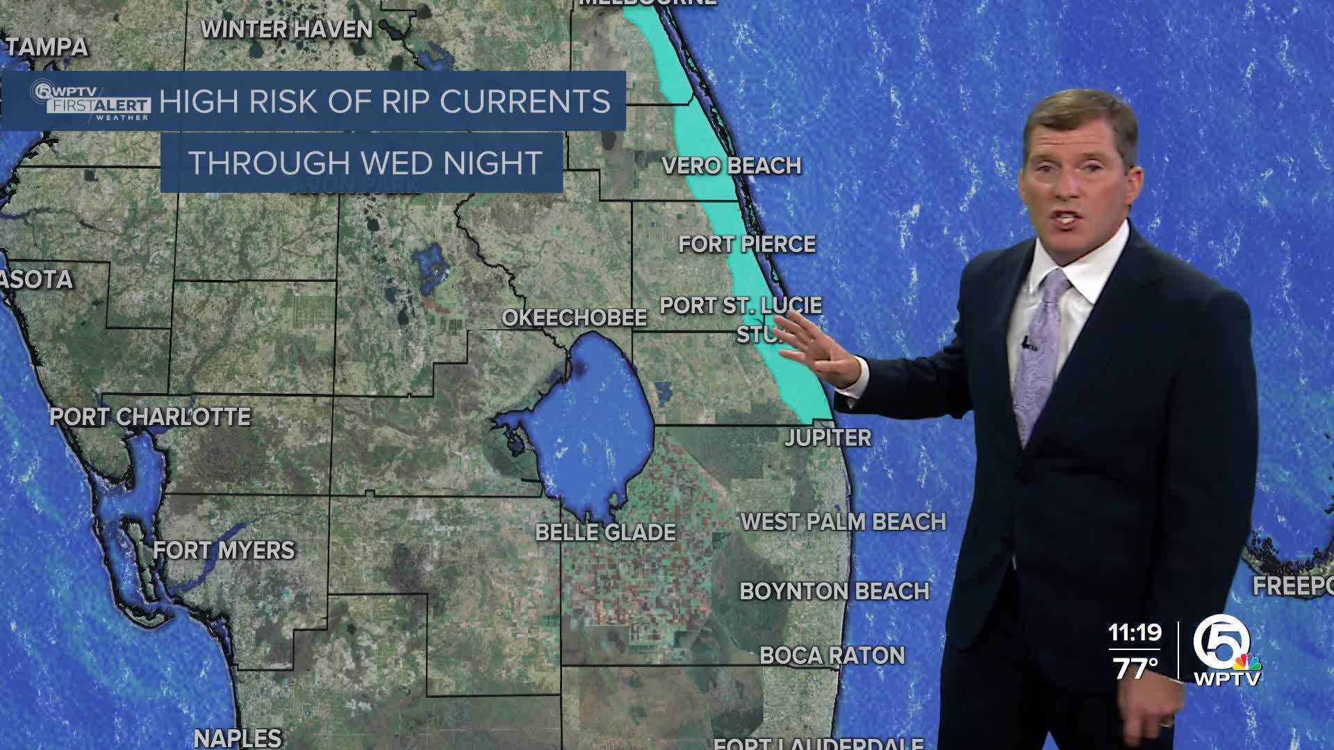
The water could be a little rough at times with 2-3 foot waves. There's also a high risk of rip currents. Please make sure you're only swimming on guarded beaches. Otherwise, expect lots of sunshine during the first part of the day with a pop up thunderstorm by afternoon. Light northeasterly winds of 5-10 mph.
Boating Forecast
A little bumpy at times, especially along the Treasure Coast. Seas of 2-3 feet. Keep an eye out for an afternoon thunderstorm. Light northeast winds.
The Tropics
We continue to watch two tropical waves east of the Leeward islands. Each wave will get better organized over the next few days as they travel west towards the Bahamas and the Turks and Caicos Islands. It's possible that both of these waves strengthen into tropical depressions by this weekend. It does appear as if the chances of either of them striking Florida is low. But if you have travel plans to Bermuda or the Outer Banks of North Carolina next week, stay updated with the forecast.
MORE WEATHER: Radar | Alerts | 7-Day Forecast | Hourly Forecast


