

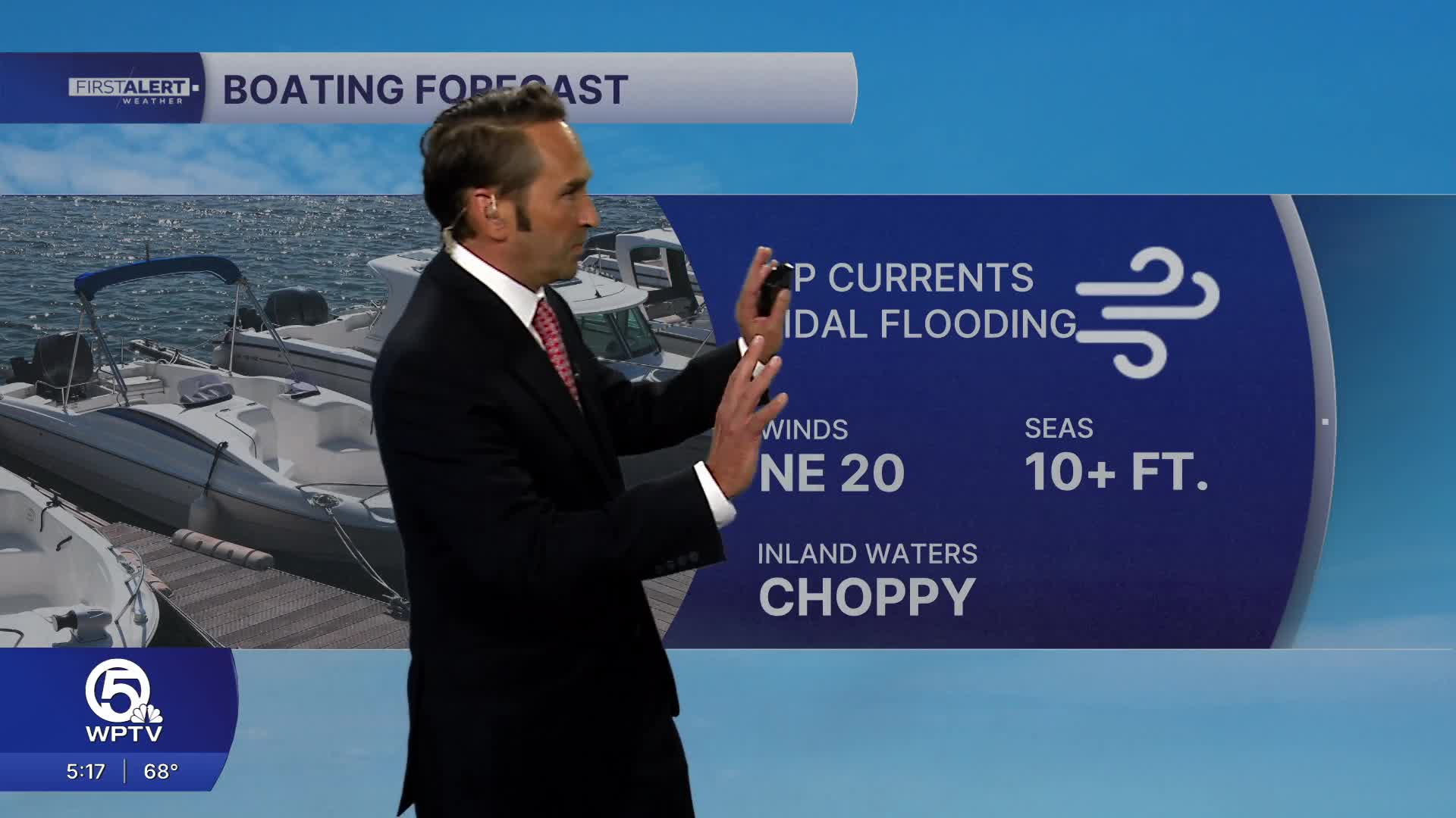


WEST PALM BEACH, Fla. — South Florida is heading into a breezy and unsettled weekend, with increasing rain chances, rough surf and hazardous boating conditions. While temperatures will remain comfortable, conditions along the coast will become increasingly challenging, especially by Sunday, when the wettest weather of the weekend is expected.
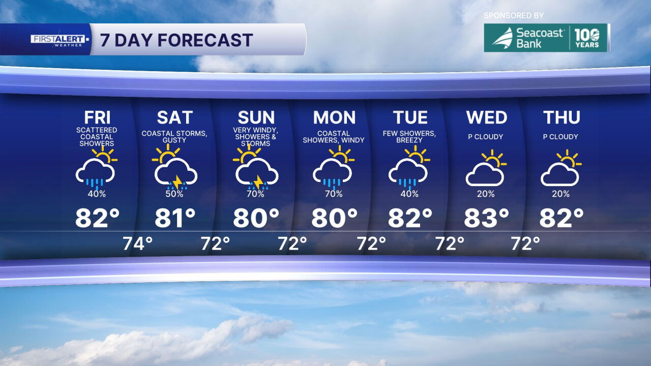
Expect mostly cloudy skies Friday, with scattered showers and occasional breaks of sunshine. Afternoon temperatures will reach the lower to middle 80s. A persistent breeze will keep coastal conditions rough, so anyone heading to the beach or out on the water should keep a close eye on the forecast.
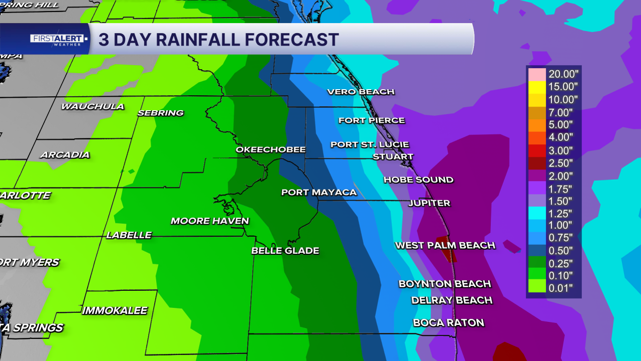
Saturday will remain breezy, with periods of showers possible throughout the day and a few thunderstorms developing during the afternoon. Highs will stay in the lower to middle 80s. While it won't be a washout, passing rain and gusty winds could interrupt outdoor activities.
Sunday is shaping up to be the most active day of the weekend. Widespread showers, periods of heavy rain and gusty winds are expected, with the potential for localized flooding in low-lying and poorly drained areas. Temperatures will remain in the lower 80s, but the combination of rain, strong winds and elevated water levels could create problems along the coast. The National Weather Service is also highlighting the potential for isolated flash flooding and coastal flooding.
Beach and boating conditions will remain hazardous throughout the weekend. King tides associated with the Full Hunter's Moon, combined with strong onshore winds, could contribute to coastal flooding and beach erosion, particularly around high tide. Rough surf and dangerous rip currents will make swimming risky along Atlantic beaches.
MORE WEATHER: Radar | Alerts | 7-Day Forecast | Hourly Forecast
Portions of this story were assisted by artificial intelligence tools and reviewed by WPTV journalists to ensure accuracy, clarity and adherence to editorial standards.


