

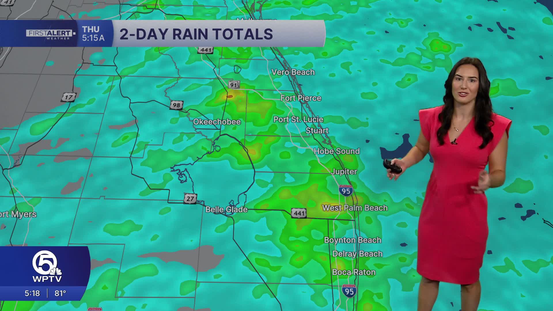


WEST PALM BEACH, Fla. — Scattered showers and thunderstorms are expected throughout Thursday morning, though some mid-level dry air filtering in from the northeast will lower rain chances slightly as the day progresses.
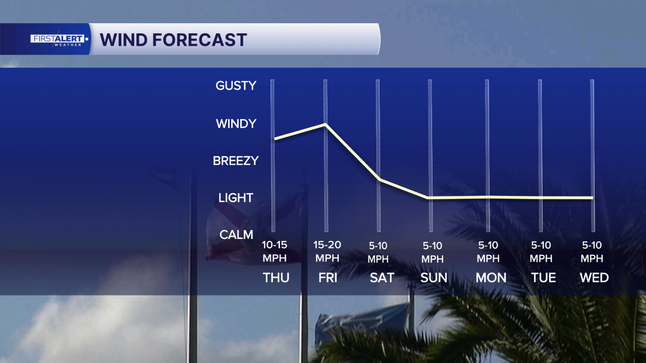
Brisk east-northeast winds are expected with occasional gusts of 20-25 mph.
High temperatures will reach the upper 80s with some spots briefly getting up to 90. Overnight lows will range from the low to mid-70s over the interior, to the upper 70s closer to the coasts.
Scattered showers and thunderstorms will continue Friday, especially during the afternoon and early evening hours. High temperatures will again reach the upper 80s to lower 90s.
Heading into the weekend and early next week, a mid- to upper-level low will move into the Gulf, bringing higher moisture levels into the region.
Light east-southeast flow this weekend will eventually become southerly by early next week.
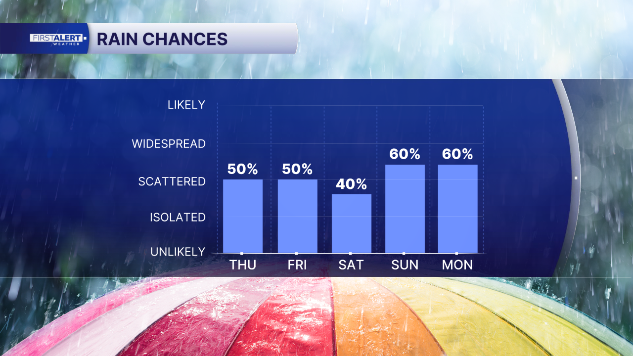
With deep tropical moisture moving into South Florida, higher rain chances are expected each day. Weak steering winds combined with high rainfall rates will make urban and poor drainage flooding the main threat through the period.
The pattern will continue to benefit ongoing drought improvement efforts across the region. Temperatures during the extended period will remain near normal, with highs generally in the upper 80s and overnight lows in the mid- to upper 70s.
MORE WEATHER: Radar | Alerts | 7-Day Forecast | Hourly Forecast
Portions of this story were assisted by artificial intelligence tools and reviewed by a WPTV journalists to ensure accuracy, clarity, and adherence to editorial standards.


