
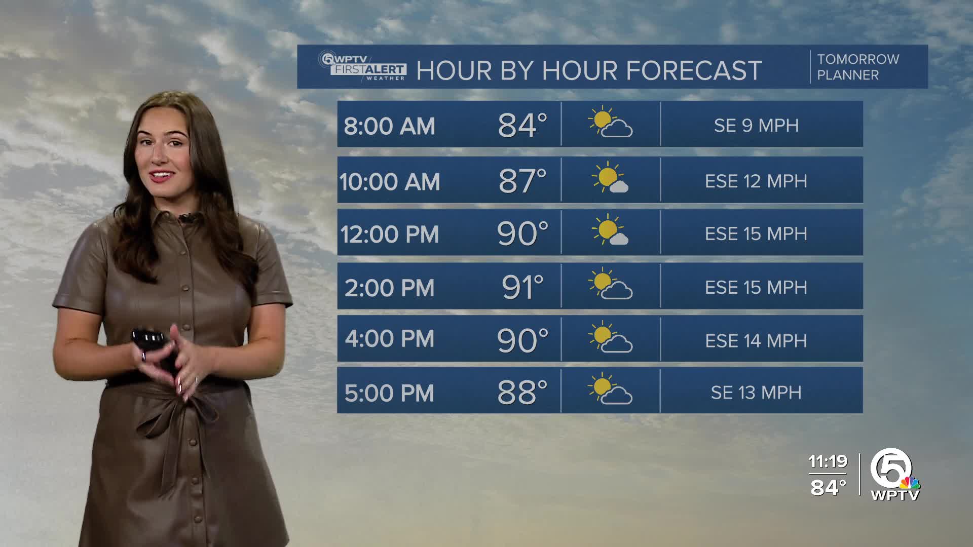


WEST PALM BEACH, Fla. — Rain chances will significantly drop by Friday thanks to a huge plume of Saharan dust and high-pressure building back in, creating intense heat. Isolated showers with rumbles of thunder are still possible in the morning.
It will be hot and humid Friday afternoon with a mostly sunny sky. Highs will be in the lower 90s with heat indices near 100-105.
It will be a bit breezy in the afternoon with southeasterly winds gusting up to 20-25 mph. This will create a bit of a chop on the water.
There is also a high risk for rip currents tomorrow.
MORE WEATHER: Radar | Alerts | 7-Day Forecast | Hourly Forecast
With low rain chances in the forecast, the weather continues to be hot and mainly sunny for the weekend. Highs will start to hit 93 and even 94 degrees on Monday.
A weak low-pressure system is forming along a stalled front in the northern Gulf and will have a chance to develop along the northern Gulf Coast as it drifts westward towards Texas.
There is also a tropical wave south of the Cabo Verde Islands that could develop briefly. It is not highlighted yet, but we are keeping an eye on it.


